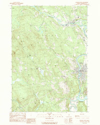
1989 Map of Madison West
USGS Topo · Published 1989About this map
The Kennebec River corridor defines this Somerset County landscape, where the confluence with the Carrabassett River at North Anson and the southern bend near Anson and Madison historically anchored local industry and settlement. The geography reflects a late 20th-century transition, balancing industrial remnants like the numerous Gravel Pits with significant historical markers such as the Arnold Trail following the riverbanks.
Find a feature on this map
43 named features on this map. Tap any name to fly to it.
Don’t see what you’re looking for? This feature index may not catch every label — zoom into the map to look around manually.
Map Details
Editions of this 1989 Madison West Map
This is the sole edition of this map. No revisions or reprints were ever made.
Other maps of this area

1894 · Norridgewock
USGS Topo · 1:62,500

1898 · Norridgewock
USGS Topo · 1:62,500

1904 · Anson
USGS Topo · 1:62,500

1924 · Farmington
USGS Topo · 1:62,500

1930 · Kingfield
USGS Topo · 1:48,000

1932 · Kingfield
USGS Topo · 1:62,500

1943 · Norridgewock
USGS Topo · 1:62,500

1948 · Bangor
USGS Topo · 1:250,000

1950 · Lewiston
USGS Topo · 1:250,000

1955 · Anson
USGS Topo · 1:62,500