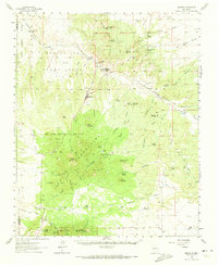
1961 Map of Madrid
USGS Topo · Published 1973About this map
Cerrillos and Madrid anchor this high-desert mining landscape, where the Atchison Topeka and Santa Fe railroad skirts the northern foothills. The region is defined by industrial extraction and cultural boundaries, most notably the North Boundary Ortiz Mine Grant and the South Boundary Mesita de Juana Lopez Grant. Deep in the Ortiz Mountains, a network of tracks like the Gypsy Trail and Stagecoach Canyon Trail provide access to the Dolores Mine and Cunningham Hill. Further south near the settlement of Golden, the San Francisco Ch stands as a focal point for the community. The map also records early indigenous history at the San Marcos Pueblo, situated near the San Marcos Arroyo, while various ranch sites like Glenn Ranch and Tinen Place appear across the arid terrain.
Find a feature on this map
95 named features on this map. Tap any name to fly to it.
Don’t see what you’re looking for? This feature index may not catch every label — zoom into the map to look around manually.
Map Details
Editions of this 1961 Madrid Map
4 editions found

Other maps of this area

1889 · Santa Fe
USGS Topo · 1:125,000

1892 · San Pedro
USGS Topo · 1:125,000

1892 · Santa Clara
USGS Topo · 1:125,000

1894 · Santa Fe
USGS Topo · 1:125,000

1894 · Lamy
USGS Topo · 1:125,000

1951 · Turquoise Hill
USGS Topo · 1:24,000

1952 · Turquoise Hill
USGS Topo · 1:24,000

1952 · Seton Village
USGS Topo · 1:24,000

1953 · Santo Domingo Pueblo
USGS Topo · 1:24,000

1953 · Tetilla Peak
USGS Topo · 1:24,000