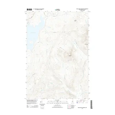
2015 Map of Magalloway Mountain
USGS Topo · Published 2015About this map
Magalloway Mountain and the high northern reaches of the Connecticut River watershed define this landscape in Coos County. In the west, the expansive First Connecticut Lake dominates the basin, fed by a complex drainage network including Merrill Brook and Barrel Brook. The terrain is characterized by sharp elevation changes, notably at Diamond Ridge and Hedgehog Nubble, which overlook the winding tributaries of the Middle Br Dead Diamond River. Access into this remote timber and sporting territory is provided by primitive routes such as Magalloway Rd and Tower Rd, connecting small water bodies like Judd Pond and Roby Brook to the larger river systems. The map details the intricate hydrography of the New Hampshire backcountry, where numerous brooks like Hellgate Brook and Machia Brook descend from the peaks to feed the East Branch Dead Diamond River.
Find a feature on this map
33 named features on this map. Tap any name to fly to it.
Don’t see what you’re looking for? This feature index may not catch every label — zoom into the map to look around manually.
Map Details
Editions of this 2015 Magalloway Mountain Map
This is the sole edition of this map. No revisions or reprints were ever made.
Other maps of this area

1925 · Indian Stream
USGS Topo · 1:48,000

1926 · Indian Stream
USGS Topo · 1:62,500

1927 · Indian Stream
USGS Topo · 1:62,500

1927 · Second Lake
USGS Topo · 1:62,500

1930 · Dixville
USGS Topo · 1:62,500

1930 · Errol
USGS Topo · 1:62,500

1932 · Second Lake
USGS Topo · 1:62,500

1933 · Dixville
USGS Topo · 1:62,500

1934 · Dixville
USGS Topo · 1:62,500

1934 · Errol
USGS Topo · 1:62,500