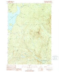
1989 Map of Magalloway Mtn
USGS Topo · Published 1989About this map
Magalloway Mountain dominates this portion of the northern New Hampshire woods, serving as a high point between the First Connecticut Lake and the drainage of the Dead Diamond River. The landscape reflects a mix of conservation and remote seasonal habitation, with the Connecticut Lakes State Forest bordering the large western lake while isolated outposts like Camp Otter and Camp No 9 sit deep within the timberlands. The hydrological network is dense, defined by numerous named brooks such as Cozzie Brook and Hellgate Brook that feed into the larger river systems.
Find a feature on this map
36 named features on this map. Tap any name to fly to it.
Don’t see what you’re looking for? This feature index may not catch every label — zoom into the map to look around manually.
Map Details
Editions of this 1989 Magalloway Mtn Map
This is the sole edition of this map. No revisions or reprints were ever made.
Other maps of this area

1925 · Indian Stream
USGS Topo · 1:48,000

1926 · Indian Stream
USGS Topo · 1:62,500

1927 · Indian Stream
USGS Topo · 1:62,500

1927 · Second Lake
USGS Topo · 1:62,500

1930 · Dixville
USGS Topo · 1:62,500

1930 · Errol
USGS Topo · 1:62,500

1932 · Second Lake
USGS Topo · 1:62,500

1933 · Dixville
USGS Topo · 1:62,500

1934 · Dixville
USGS Topo · 1:62,500

1934 · Errol
USGS Topo · 1:62,500