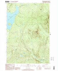
1997 Map of Magalloway Mtn
USGS Topo · Published 2000About this map
The high peaks of the New Hampshire Great North Woods dominate this landscape, centered on the prominence of Magalloway Mountain. This area of Coos County is defined by its timber and watershed history, where the headwaters of the Connecticut River flow from the expanse of First Connecticut Lake into the protected lands of the Connecticut Lakes State Forest. The map captures the remote character of Pittsburg and the Atkinson and Gilmanton Academy Grant during the late 20th century, a time when logging roads and seasonal camps shaped the local economy.
Find a feature on this map
33 named features on this map. Tap any name to fly to it.
Don’t see what you’re looking for? This feature index may not catch every label — zoom into the map to look around manually.
Map Details
Editions of this 1997 Magalloway Mtn Map
This is the sole edition of this map. No revisions or reprints were ever made.
Other maps of this area

1925 · Indian Stream
USGS Topo · 1:48,000

1926 · Indian Stream
USGS Topo · 1:62,500

1927 · Indian Stream
USGS Topo · 1:62,500

1927 · Second Lake
USGS Topo · 1:62,500

1930 · Dixville
USGS Topo · 1:62,500

1930 · Errol
USGS Topo · 1:62,500

1932 · Second Lake
USGS Topo · 1:62,500

1933 · Dixville
USGS Topo · 1:62,500

1934 · Dixville
USGS Topo · 1:62,500

1934 · Errol
USGS Topo · 1:62,500