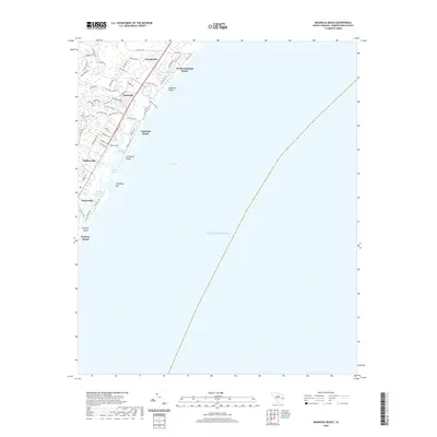
2020 Map of Magnolia Beach
USGS Topo · Published 2020About this map
Litchfield Beach and the surrounding coastal hamlets define this corner of the South Carolina Grand Strand. The landscape is shaped by the tidal interface of the Atlantic Ocean and a complex network of marshes, including Pawleys Island Creek and Clubhouse Creek. Coastal development is concentrated along the barrier sands, with established neighborhoods like North Litchfield Beach, Magnolia Beach, and Annieville tucked between the highway and the shore.
Find a feature on this map
61 named features on this map. Tap any name to fly to it.
Don’t see what you’re looking for? This feature index may not catch every label — zoom into the map to look around manually.
Map Details
Editions of this 2020 Magnolia Beach Map
This is the sole edition of this map. No revisions or reprints were ever made.
Other maps of this area

1937 · Myrtle Beach
USGS Topo · 1:48,000

1940 · Myrtle Beach
USGS Topo · 1:62,500

1942 · North Island
USGS Topo · 1:24,000

1942 · Magnolia Beach
USGS Topo · 1:24,000

1942 · Waverly Mills
USGS Topo · 1:24,000

1943 · Brookgreen
USGS Topo · 1:24,000

1943 · Plantersville
USGS Topo · 1:24,000

1949 · Georgetown
USGS Topo · 1:250,000

1967 · Georgetown
USGS Topo · 1:250,000

1974 · Georgetown
USGS Topo · 1:250,000