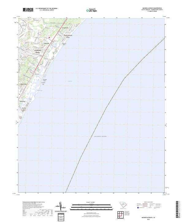
2024 Map of Magnolia Beach
USGS Topo · Published 2024About this map
Litchfield Beach and the surrounding coastal communities characterize this segment of the South Carolina Grand Strand as it appeared in recent years. The map documents the intricate barrier island and marsh systems, highlighting the narrow Litchfield Spit and the tidal waters of Pawleys Island Creek. Inland from the Atlantic Ocean, several established settlements are visible, including Georgieville, Annieville, and Parkersville, showing the residential development patterns that define the region. The landscape is a mix of coastal wetlands and structured neighborhoods, with features like Flagg Pond and Clubhouse Creek providing natural drainage points. This detailed survey captures the contemporary layout of Pawleys Island and its relationship with Long Bay, reflecting the modern footprint of these historic seaside locales.
Find a feature on this map
66 named features on this map. Tap any name to fly to it.
Don’t see what you’re looking for? This feature index may not catch every label — zoom into the map to look around manually.
Map Details
Editions of this 2024 Magnolia Beach Map
This is the sole edition of this map. No revisions or reprints were ever made.
Other maps of this area

1937 · Myrtle Beach
USGS Topo · 1:48,000

1940 · Myrtle Beach
USGS Topo · 1:62,500

1942 · North Island
USGS Topo · 1:24,000

1942 · Magnolia Beach
USGS Topo · 1:24,000

1942 · Waverly Mills
USGS Topo · 1:24,000

1943 · Brookgreen
USGS Topo · 1:24,000

1943 · Plantersville
USGS Topo · 1:24,000

1949 · Georgetown
USGS Topo · 1:250,000

1967 · Georgetown
USGS Topo · 1:250,000

1974 · Georgetown
USGS Topo · 1:250,000