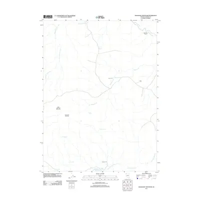
2011 Map of Mahogany Mountain
USGS Topo · Published 2011About this map
Mahogany Mountain dominates this high-desert portion of Washoe County, a landscape defined by seasonal water sources and remote cattle-working sites. The topography reveals a series of critical springs and catchments essential for life in this arid environment, including Al Owens Spring, Cherry Spring, and the Sage Hen Spring. These water points support the dispersed human presence marked by sites such as Pappys Corral and Brush Corral, which suggest a continuing history of ranching and livestock management in the Great Basin.
Find a feature on this map
18 named features on this map. Tap any name to fly to it.
Don’t see what you’re looking for? This feature index may not catch every label — zoom into the map to look around manually.
Map Details
Editions of this 2011 Mahogany Mountain Map
This is the sole edition of this map. No revisions or reprints were ever made.
Other maps of this area

1889 · Long Valley
USGS Topo · 1:250,000

1954 · Vya
USGS Topo · 1:250,000

1958 · Vya
USGS Topo · 1:250,000

1962 · Vya
USGS Topo · 1:250,000

1972 · Mahogany Mtn
USGS Topo · 1:24,000

1972 · High Rock Lake
USGS Topo · 1:24,000
1972 · Yellow Hills East
USGS Topo · 1:24,000
1972 · Yellow Hills West
USGS Topo · 1:24,000

1978 · Hart Mountain
USGS Topo · 1:24,000
1979 · Nellie Spring Mtn
USGS Topo · 1:24,000