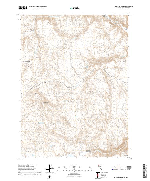
2021 Map of Mahogany Mountain
USGS Topo · Published 2021About this map
Mahogany Mountain and the surrounding high desert of Washoe County are defined by a complex network of seasonal water sources and deep volcanic drainages. This landscape, as documented in 2021, centers on the massive volcanic tablelands of the Little High Rock Mountains and the prominent Division Range to the southeast. Water is the primary driver of naming and activity here, with scattered vital points like Big Mahogany Reservoir and several named springs including Al Owens Spring, Cherry Spring, and the curiously named Pappys Corral Spring. The map traces the winding paths of High Rock Canyon and Yellow Rock Canyon, where intermittent flows like Yellow Rock Canon Creek and Little High Rock Creek have carved significant relief into the plateau. These features represent essential landmarks for navigation and land use in this arid portion of Nevada.
Find a feature on this map
22 named features on this map. Tap any name to fly to it.
Don’t see what you’re looking for? This feature index may not catch every label — zoom into the map to look around manually.
Map Details
Editions of this 2021 Mahogany Mountain Map
This is the sole edition of this map. No revisions or reprints were ever made.
Other maps of this area

1889 · Long Valley
USGS Topo · 1:250,000

1954 · Vya
USGS Topo · 1:250,000

1958 · Vya
USGS Topo · 1:250,000

1962 · Vya
USGS Topo · 1:250,000

1972 · Mahogany Mtn
USGS Topo · 1:24,000

1972 · High Rock Lake
USGS Topo · 1:24,000
1972 · Yellow Hills East
USGS Topo · 1:24,000
1972 · Yellow Hills West
USGS Topo · 1:24,000

1978 · Hart Mountain
USGS Topo · 1:24,000
1979 · Nellie Spring Mtn
USGS Topo · 1:24,000