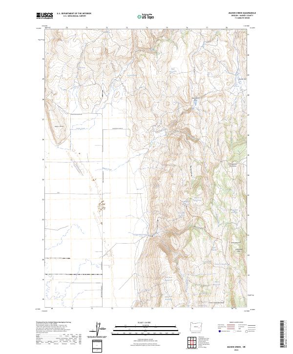
2024 Map of Mahon Creek
USGS Topo · Published 2024About this map
The Stinkingwater Mountains and Crane Creek Mountains anchor this high-desert landscape in Harney County. The terrain is defined by a sophisticated water-management system of upland catchments, including Big Spring Reservoir, Crowcamp Reservoir, and Rector Reservoir, which supported the region's livestock economy. The movement of cattle is explicitly marked by the Miller Stock Trail RIPS 710361 Trl, which winds through Box Canyon and the Crowcamp Hills.
Find a feature on this map
43 named features on this map. Tap any name to fly to it.
Don’t see what you’re looking for? This feature index may not catch every label — zoom into the map to look around manually.
Map Details
Editions of this 2024 Mahon Creek Map
This is the sole edition of this map. No revisions or reprints were ever made.
Other maps of this area

1955 · Burns
USGS Topo · 1:250,000

1958 · Burns
USGS Topo · 1:250,000

1959 · Burns
USGS Topo · 1:250,000

1960 · Crane
USGS Topo · 1:62,500

1968 · Venator
USGS Topo · 1:62,500
1972 · Tin Can Ridge
USGS Topo · 1:24,000

1973 · Buchanan
USGS Topo · 1:24,000

1973 · Mahon Creek
USGS Topo · 1:24,000

1973 · Carson Point
USGS Topo · 1:24,000
1977 · Bartlett Mtn
USGS Topo · 1:24,000