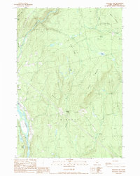
1989 Map of Mahoney Hill
USGS Topo · Published 1989About this map
Bingham and the outlying settlement of Johnson Corner anchor this landscape along the eastern bank of the Kennebec River. The terrain is defined by dramatic ridgelines including Mahoney Hill, Johnson Mountain, and Babbitt Ridge, which channel a network of drainages like Austin Stream and Bassett Brook toward the river valley. The eastern portion of the sheet is dominated by the unorganized territory of Mayfield, showing the characteristic lack of dense settlement common in the Maine North Woods during the late 20th century.
Find a feature on this map
28 named features on this map. Tap any name to fly to it.
Don’t see what you’re looking for? This feature index may not catch every label — zoom into the map to look around manually.
Map Details
Editions of this 1989 Mahoney Hill Map
This is the sole edition of this map. No revisions or reprints were ever made.
Other maps of this area

1903 · Bingham
USGS Topo · 1:62,500

1904 · Anson
USGS Topo · 1:62,500

1905 · Bingham
USGS Topo · 1:62,500

1913 · Skowhegan
USGS Topo · 1:62,500

1948 · Bangor
USGS Topo · 1:250,000

1948 · Kingsbury
USGS Topo · 1:62,500

1950 · Kingsbury
USGS Topo · 1:62,500

1954 · Millinocket
USGS Topo · 1:250,000

1955 · Anson
USGS Topo · 1:62,500

1955 · Skowhegan
USGS Topo · 1:62,500