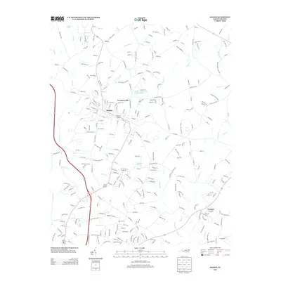
2013 Map of Maiden
USGS Topo · Published 2013About this map
Maiden serves as a central hub for this portion of the North Carolina landscape, where a dense network of local roads connects several outlying communities and rural landmarks. The town is flanked by a complex system of waterways, including Maiden Cr and Pinch Gut Cr to the north, and Larkard Cr to the south. Notable local industry and infrastructure are evident at the Maiden Water Plant Lake, while small residential pockets like Duan and Acre Hts mark the transition from the town center to the surrounding countryside.
Find a feature on this map
279 named features on this map. Tap any name to fly to it.
Don’t see what you’re looking for? This feature index may not catch every label — zoom into the map to look around manually.
Map Details
Editions of this 2013 Maiden Map
This is the sole edition of this map. No revisions or reprints were ever made.
Other maps of this area

1895 · Hickory
USGS Topo · 1:125,000

1909 · Lincolnton
USGS Topo · 1:62,500

1911 · Lincolnton
USGS Topo · 1:62,500

1914 · Gastonia
USGS Topo · 1:48,000

1916 · Gastonia
USGS Topo · 1:62,500

1953 · Charlotte
USGS Topo · 1:250,000

1954 · Charlotte
USGS Topo · 1:250,000

1960 · Charlotte
USGS Topo · 1:250,000

1962 · Charlotte
USGS Topo · 1:250,000
1970 · Lincolnton East
USGS Topo · 1:24,000