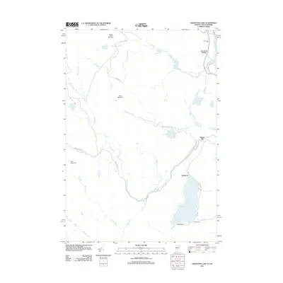
2012 Map of Maidstone Lake
USGS Topo · Published 2012About this map
Maidstone Lake dominates the southern landscape of this Vermont terrain, serving as a primary focal point for the region's geography and recreation with Camping Area A and Camping Area B along its eastern shores. The area is defined by its complex network of waterways, including the winding Paul Stream and its numerous tributaries such as Notch Pond Brook and Madison Brook. Settlement is sparse, anchored by Brunswick Springs near the Connecticut Cem in the northeast and Browns Mill to the east. High ground is marked by prominent peaks like Notch Pond Mountain, West Mountain, and Bull Mountain. The map details a landscape of managed forest and remote ponds, including South American Pond and Wheeler Pond, connected by utility roads and trails like Morrow Trl and Notch Pond Rd, reflecting a modern era of timber management and conservation.
Find a feature on this map
42 named features on this map. Tap any name to fly to it.
Don’t see what you’re looking for? This feature index may not catch every label — zoom into the map to look around manually.
Map Details
Editions of this 2012 Maidstone Lake Map
This is the sole edition of this map. No revisions or reprints were ever made.
Other maps of this area

1920 · Guildhall
USGS Topo · 1:62,500

1924 · Island Pond
USGS Topo · 1:48,000

1926 · Island Pond
USGS Topo · 1:62,500

1929 · Averill
USGS Topo · 1:62,500

1931 · Guildhall
USGS Topo · 1:48,000

1933 · Guildhall
USGS Topo · 1:48,000

1937 · Guildhall
USGS Topo · 1:62,500

1950 · Lewiston
USGS Topo · 1:250,000

1951 · Burke
USGS Topo · 1:62,500

1953 · Island Pond
USGS Topo · 1:62,500