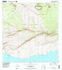
1995 Map of Makaopuhi Crater
USGS Topo · Published 1999About this map
Makaopuhi Crater and the surrounding volcanic landscape of Hawaii Volcanoes National Park dominate this survey, which documents decades of active geological transformation. The map identifies specific flows by year, including the Lava Flow of 1974 and the Lava Flow of 1969, illustrating how the terrain was continuously reshaped in the late 20th century. Cultural sites along the coast, such as Keauhou Landing (Site) and Kealakomo (Site), reflect the historical footprint of human settlement in a region defined by its precarious proximity to active vents like Mauna Ulu and Pu`u `O`o. The route of the Chain of Craters Road serves as the primary artery through this wilderness, navigating the steep drops of Holei Pali toward the Pacific Ocean. Internal district boundaries between the Ka`u District and Puna District bisect the park, marking administrative lines across fields of cooled basalt and scattered kipuka.
Find a feature on this map
38 named features on this map. Tap any name to fly to it.
Don’t see what you’re looking for? This feature index may not catch every label — zoom into the map to look around manually.
Map Details
Editions of this 1995 Makaopuhi Crater Map
This is the sole edition of this map. No revisions or reprints were ever made.
Other maps of this area

1921 · Kilauea
USGS Topo · 1:62,500

1922 · Puna
USGS Topo · 1:62,500

1923 · Pahala
USGS Topo · 1:62,500

1924 · Kilauea
USGS Topo · 1:62,500

1924 · Puna
USGS Topo · 1:62,500

1954 · Hawaii South
USGS Topo · 1:250,000

1959 · Hawaii South
USGS Topo · 1:250,000

1961 · Hawaii South
USGS Topo · 1:250,000

1962 · Hawaii South
USGS Topo · 1:250,000
1963 · Volcano
USGS Topo · 1:24,000