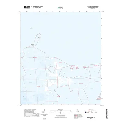
2018 Map of Malheureux Point
USGS Topo · Published 2018About this map
Malheureux Point anchors a shifting coastal landscape at the edge of Lake Borgne in Saint Bernard Parish. This aquatic environment is defined by an intricate network of tidal channels and islands, where Le Petit Pass separates the mainland from Le Petit Pass Island. The map illustrates a labyrinth of waterways that speak to the region's traditional maritime and trapping history, featuring evocative names like Trappers Bayou and Whiskey Bayou. Further south and east, the territory transitions into larger open waters such as Ninemile Bay and False Mouth Bay, with Raccoon Island marking the southeastern reaches. The absence of roads emphasizes the isolation of this marshland, where navigation is dictated by passages like Blind Pass and Mosquito Inlet.
Find a feature on this map
21 named features on this map. Tap any name to fly to it.
Don’t see what you’re looking for? This feature index may not catch every label — zoom into the map to look around manually.
Map Details
Editions of this 2018 Malheureux Point Map
This is the sole edition of this map. No revisions or reprints were ever made.
Other maps of this area

1893 · Rigolets
USGS Topo · 1:62,500

1893 · Shell Beach
USGS Topo · 1:62,500

1893 · Toulme
USGS Topo · 1:62,500

1895 · Bodreau
USGS Topo · 1:62,500

1935 · English Lookout
USGS Topo · 1:31,680

1935 · Grand Island Pass
USGS Topo · 1:31,680

1936 · Rigolets
USGS Topo · 1:62,500

1939 · Shell Beach
USGS Topo · 1:62,500

1941 · Shell Beach
USGS Topo · 1:62,500

1946 · Oak Mound Bayou
USGS Topo · 1:31,680