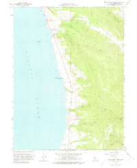
1960 Map of Mallo Pass Creek
USGS Topo · Published 1974About this map
Bridgeport Landing (Site) sits at the edge of the Pacific Ocean on this 1960 Mendocino coast survey. The terrain is characterized by steep coastal drainages and prominent ridges, with the high ground of Cliff Ridge overlooking a series of westward-flowing waters including Elk Creek, Greenwood Creek, and Mallo Pass Creek. The landscape shows a network of jeep trails and unimproved dirt roads winding through the elevations of Bald Hill, reflecting the localized movement and land use of the mid-20th century.
Find a feature on this map
25 named features on this map. Tap any name to fly to it.
Don’t see what you’re looking for? This feature index may not catch every label — zoom into the map to look around manually.
Map Details
Editions of this 1960 Mallo Pass Creek Map
3 editions found
Other maps of this area

1943 · Point Arena
USGS Topo · 1:62,500

1943 · Albion
USGS Topo · 1:62,500

1943 · Navarro
USGS Topo · 1:62,500

1944 · Saddle Point
USGS Topo · 1:62,500

1947 · Santa Rosa
USGS Topo · 1:250,000

1949 · Santa Rosa
USGS Topo · 1:250,000

1957 · Ukiah
USGS Topo · 1:250,000

1958 · Santa Rosa
USGS Topo · 1:250,000

1960 · Ukiah
USGS Topo · 1:250,000
1960 · Elk
USGS Topo · 1:24,000