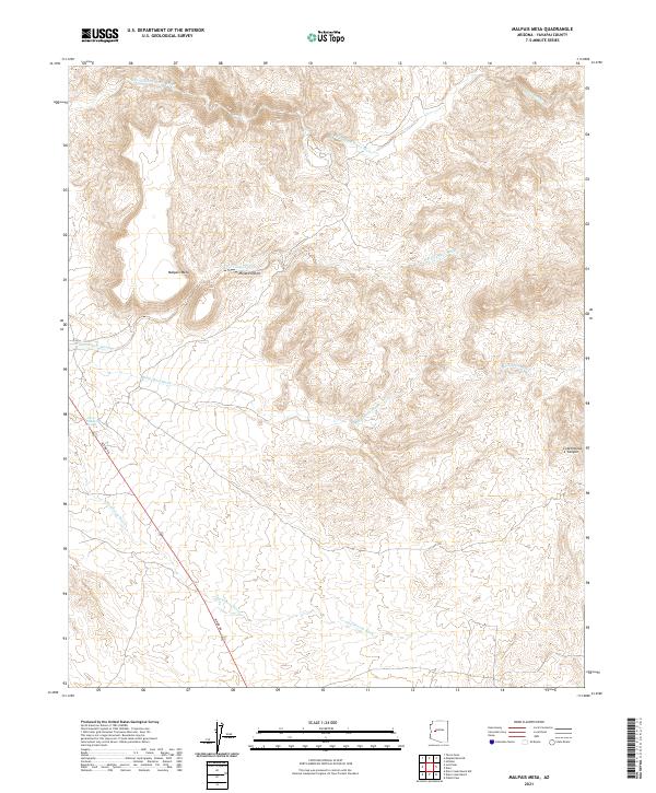
2021 Map of Malpais Mesa
USGS Topo · Published 2021About this map
Malpais Mesa rises as a prominent landmark within the Mojave Desert, defining the arid landscape of this Yavapai County territory. Drainage patterns are heavily marked by seasonal watercourses like Black Canyon Wash and Black Mesa Wash, which carve through the high ground toward the S Fork Santa Maria River in the north. The presence of Lower Hackberry Spring provides a critical water source in an otherwise dry environment, situated near the western edge of the mesa. Alamo Rd serves as the primary corridor through the southwestern portion of the map, following the path of Hackberry Wash. This area exhibits the characteristic transition from rugged canyon terrain, such as Cottonwood Canyon, to the broad, open stretches of the eastern desert flats.
Find a feature on this map
14 named features on this map. Tap any name to fly to it.
Don’t see what you’re looking for? This feature index may not catch every label — zoom into the map to look around manually.
Map Details
Editions of this 2021 Malpais Mesa Map
This is the sole edition of this map. No revisions or reprints were ever made.
Other maps of this area

1887 · Prescott
USGS Topo · 1:250,000

1892 · Prescott
USGS Topo · 1:250,000

1903 · Congress
USGS Topo · 1:125,000

1904 · Congress
USGS Topo · 1:125,000

1923 · Signal
USGS Topo · 1:250,000

1942 · Signal
USGS Topo · 1:250,000

1950 · Prescott
USGS Topo · 1:250,000

1954 · Prescott
USGS Topo · 1:250,000

1958 · Prescott
USGS Topo · 1:250,000

1959 · Prescott
USGS Topo · 1:250,000