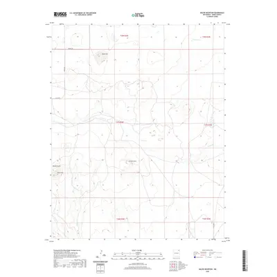
2020 Map of Malpie Mountain
USGS Topo · Published 2020About this map
Malpie Mtn and Lonesome Mtn dominate the high plateau of Union County in this modern topographic survey. The landscape is defined by intermittent drainage systems, notably the winding path of Carrizo Cr through the center of the quadrangle and the deep cut of Barela Canyon to the west. This arid expanse shows a sparse network of ranching and access routes, including Kennedy Rd and Malpie Rd, which connect isolated water features like Moore Lake to the broader high plains. The map provides a precise look at the township and range divisions that have shaped New Mexico land ownership for generations, illustrating how terrain features like Barela Mtn and Armijo Cr intersect with these legal boundaries in a region where water and elevation dictate the utility of the land.
Find a feature on this map
18 named features on this map. Tap any name to fly to it.
Don’t see what you’re looking for? This feature index may not catch every label — zoom into the map to look around manually.
Map Details
Editions of this 2020 Malpie Mountain Map
This is the sole edition of this map. No revisions or reprints were ever made.
Other maps of this area

1954 · Raton
USGS Topo · 1:250,000

1954 · Dalhart
USGS Topo · 1:250,000

1958 · Raton
USGS Topo · 1:250,000

1958 · Dalhart
USGS Topo · 1:250,000

1962 · Dalhart
USGS Topo · 1:250,000

1971 · Kiowa
USGS Topo · 1:24,000

1971 · Palo Blanco Mountain
USGS Topo · 1:24,000

1972 · Little Grande
USGS Topo · 1:24,000

1972 · Capulin
USGS Topo · 1:24,000

1972 · Malpie Mountain
USGS Topo · 1:24,000