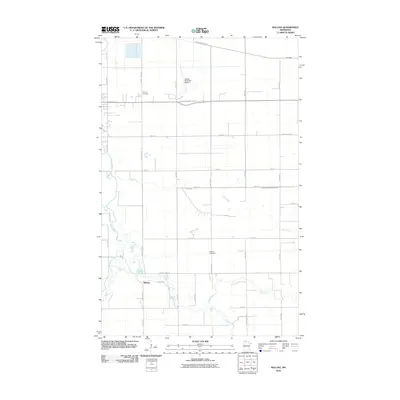
2010 Map of Malung
USGS Topo · Published 2010About this map
Malung sits as the central settlement in this portion of Roseau County, where the South Fork Roseau River and Sucker Creek converge before joining the main Roseau River channel. The landscape is defined by a dense grid of agricultural section roads and a complex drainage network including Cow Creek, Bear Creek, and the man-made County Ditch Number Eleven. Transportation and infrastructure are anchored by the Roseau Municipal Airport and a series of county highways that connect remote farmsteads to the regional center. Local genealogy is supported by the presence of Spruce Cemetery in the north and Malung Cemetery near the town site, while the naming of Mattson Island Rd suggests the historical importance of specific family landholdings in navigating this water-rich prairie environment.
Find a feature on this map
37 named features on this map. Tap any name to fly to it.
Don’t see what you’re looking for? This feature index may not catch every label — zoom into the map to look around manually.
Map Details
Editions of this 2010 Malung Map
This is the sole edition of this map. No revisions or reprints were ever made.
Other maps of this area

1918 · Goos
USGS Topo · 1:62,500

1918 · Pencer
USGS Topo · 1:62,500

1918 · Roseau
USGS Topo · 1:62,500

1918 · Garland
USGS Topo · 1:62,500

1943 · Goos
USGS Topo · 1:62,500

1954 · Roseau
USGS Topo · 1:250,000

1957 · Roseau
USGS Topo · 1:250,000

1958 · Roseau
USGS Topo · 1:250,000

1966 · Salol NW
USGS Topo · 1:24,000

1966 · Malung
USGS Topo · 1:24,000