
1966 Map of Salol NW
USGS Topo · Published 1968About this map
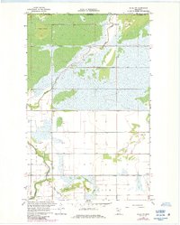
Sprague Creek meanders through this borderland landscape in northern Roseau County, where the transition from wild marsh to organized farmland is clearly visible. The terrain is defined by an extensive drainage network, including Judicial Ditch No 61, County Ditch No 18, and County Ditch No 7, illustrating the mid-century engineering efforts to manage the low-lying wetlands of the Roseau River basin. A prominent Gaging Station on Sprague Creek near the international boundary highlights the importance of hydrological monitoring in this sensitive watershed.
Find a feature on this map
12 named features on this map. Tap any name to fly to it.
Don’t see what you’re looking for? This feature index may not catch every label — zoom into the map to look around manually.
Map Details
Editions of this 1966 Salol NW Map
2 editions found
Other maps of this area

1918 · Goos
USGS Topo · 1:62,500

1918 · Roseau
USGS Topo · 1:62,500

1943 · Goos
USGS Topo · 1:62,500

1954 · Roseau
USGS Topo · 1:250,000

1957 · Roseau
USGS Topo · 1:250,000

1958 · Roseau
USGS Topo · 1:250,000

1963 · Kenora
USGS Topo · 1:250,000

1966 · Malung
USGS Topo · 1:24,000
1966 · Roseau
USGS Topo · 1:24,000
1966 · Salol
USGS Topo · 1:24,000