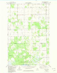
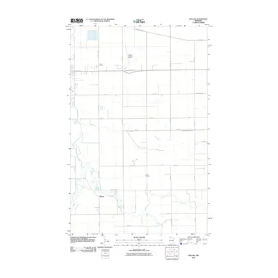
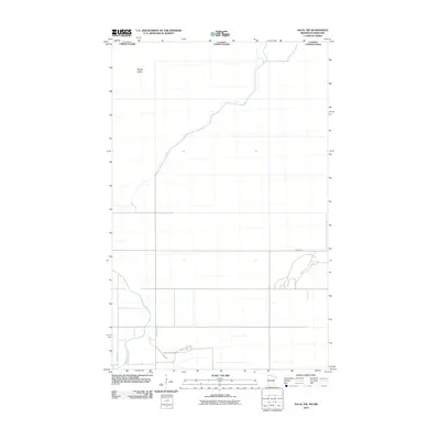
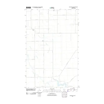
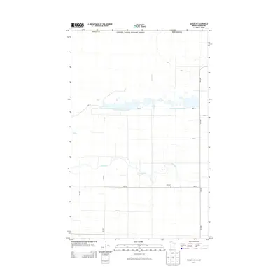
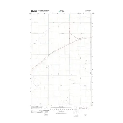
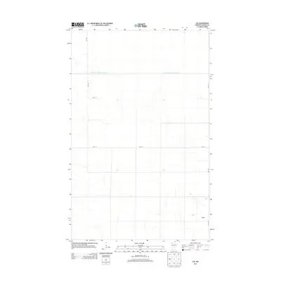
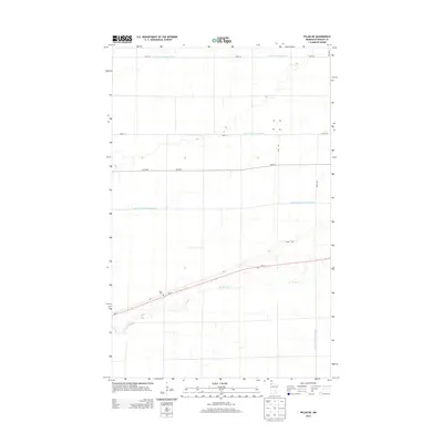
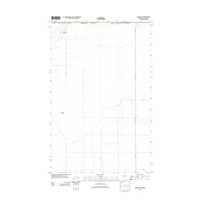
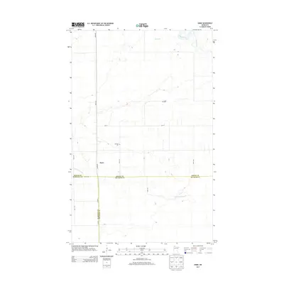
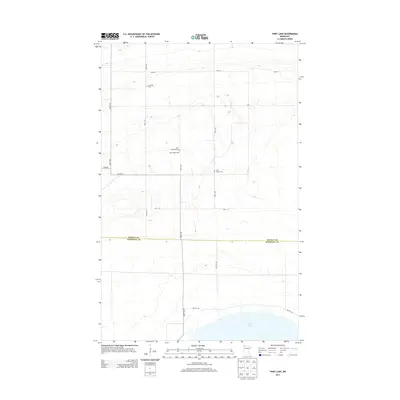
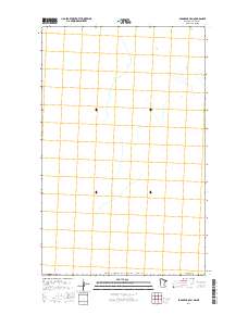
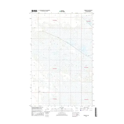
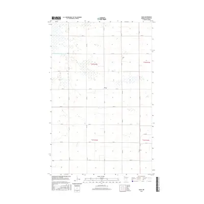
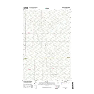
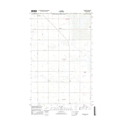
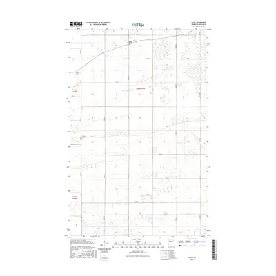
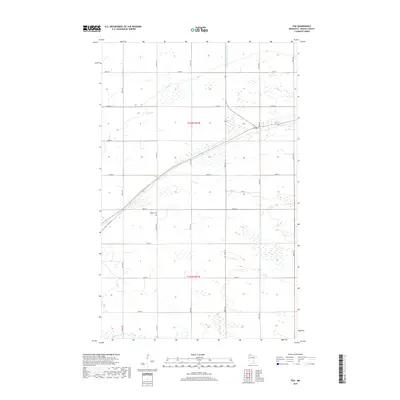
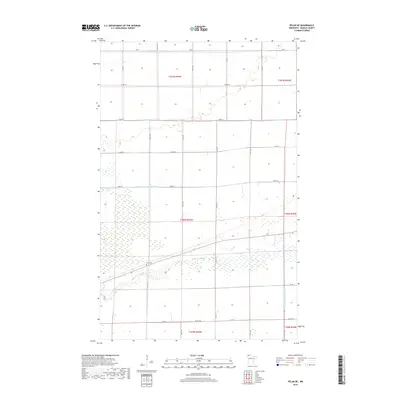
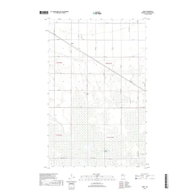
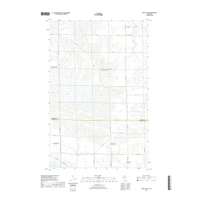
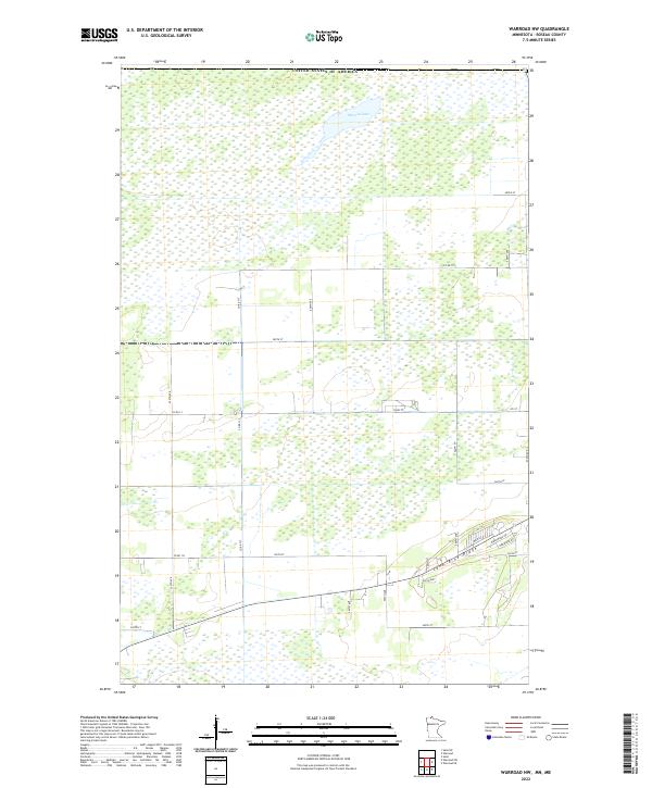
1967 Map of Warroad NW
USGS Topo · Published 1969About this map
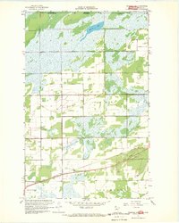
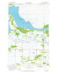
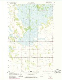
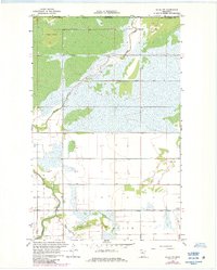
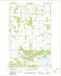
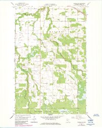
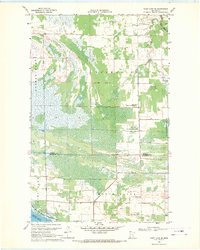
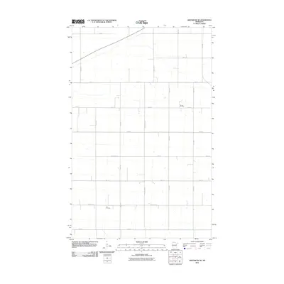
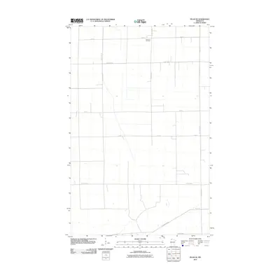
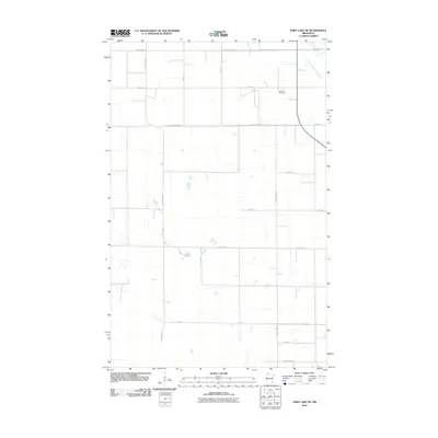
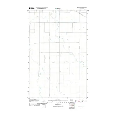
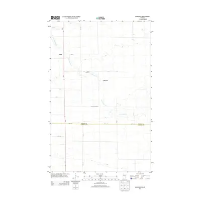
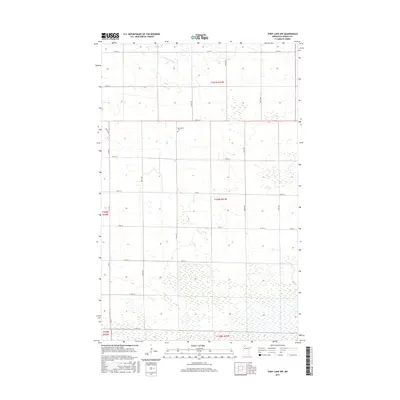
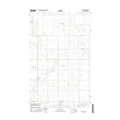
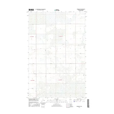
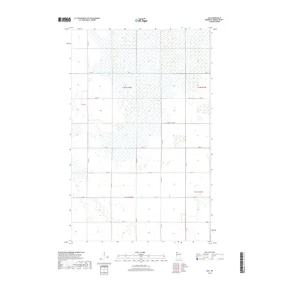
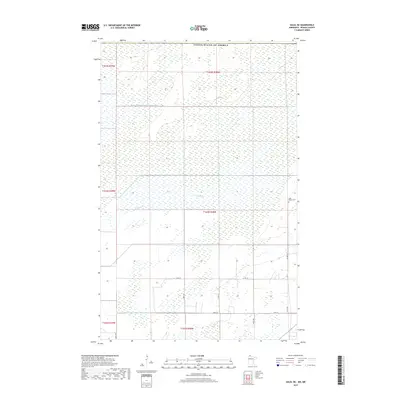
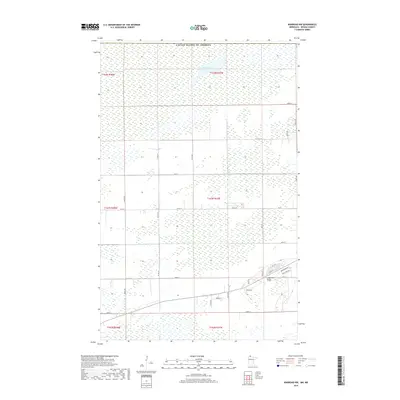
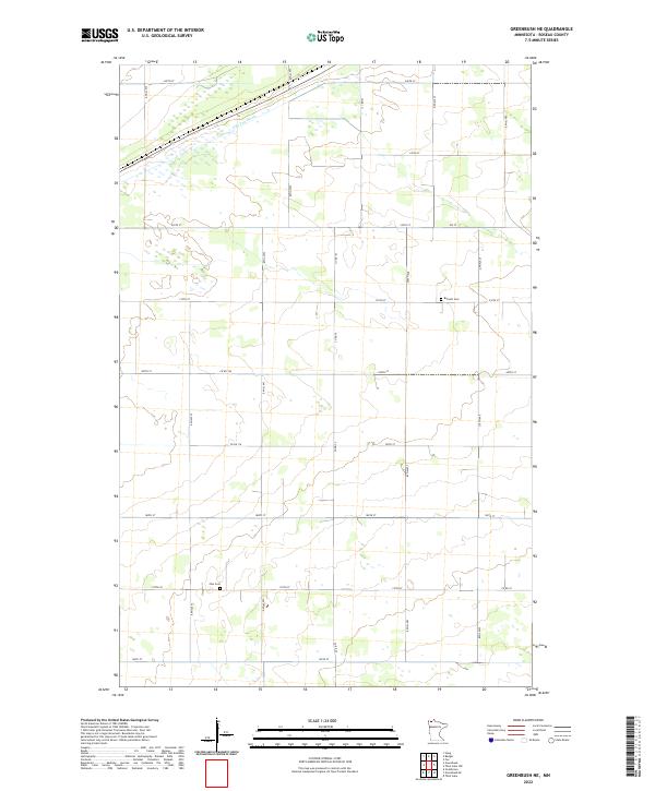
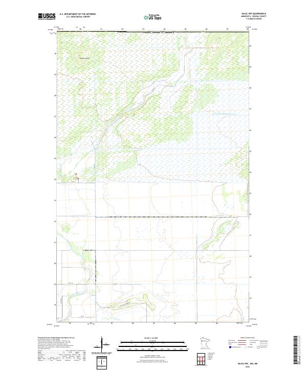
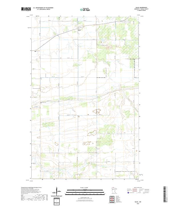
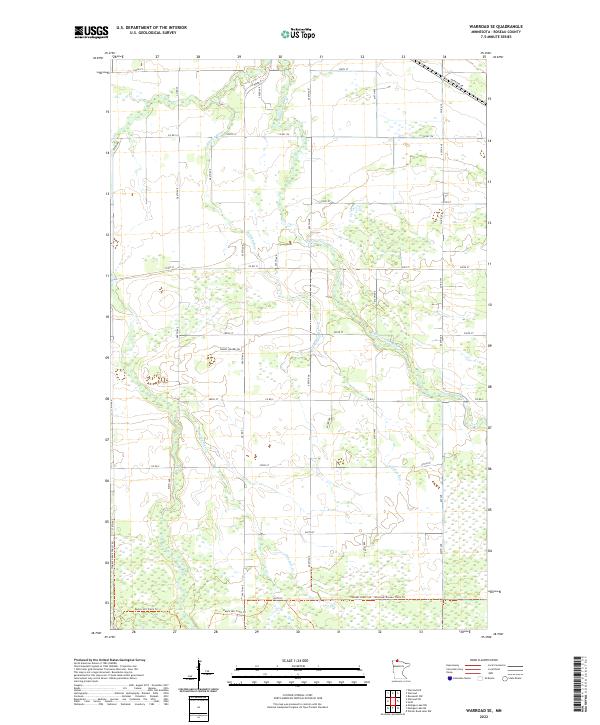
The Canada United States border defines the northern edge of this Roseau County landscape, where the flat timberland and peat bogs of the far north meet a highly engineered drainage system. Judicial Ditch No 61 and Co Ditch No 6 cut through the terrain, reflecting the mid-century effort to manage water levels for agriculture and forestry. Marvin Lake sits prominently in the northern section, while the southern portion of the quadrangle shows the transition to more settled townships like Enstrom and Cedar Bend. Transport and topography are closely linked here; the Great Northern railway line follows the natural high ground of Lone Pine Ridge, avoiding the lower marshy areas. This alignment demonstrates how early infrastructure in the region was dictated by subtle glacial landforms, providing a reliable path across the wet northern plains of Manitoba and Minnesota.
Find a feature on this map
13 named features on this map. Tap any name to fly to it.
Don’t see what you’re looking for? This feature index may not catch every label — zoom into the map to look around manually.
Map Details
Editions of this 1967 Warroad NW Map
This is the sole edition of this map. No revisions or reprints were ever made.
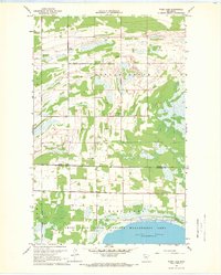
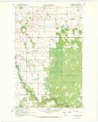
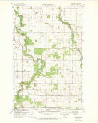
Historical Maps of Roseau County Through Time
195 maps found

1918 Garland
Roseau County, MN

1918 Goos
Roseau County, MN

1918 Pencer
Roseau County, MN

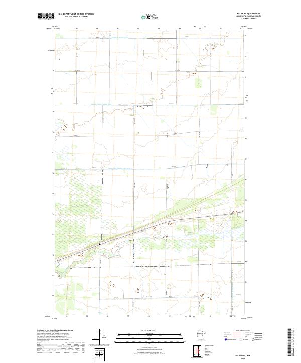
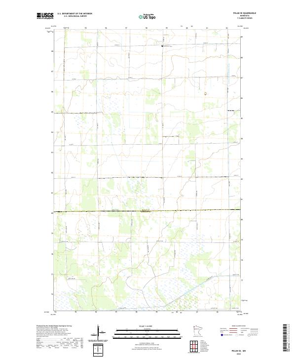
1919 Pelan
Roseau County, MN

1930 Juneberry
Roseau County, MN

1932 Juneberry
Roseau County, MN

1943 Goos
Roseau County, MN

1957 Pelan
Roseau County, MN
1962 Greenbush NE
Roseau County, MN
1962 Greenbush SE
Roseau County, MN
1966 Badger NE
Roseau County, MN
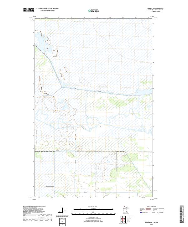
1966 Badger NW
Roseau County, MN
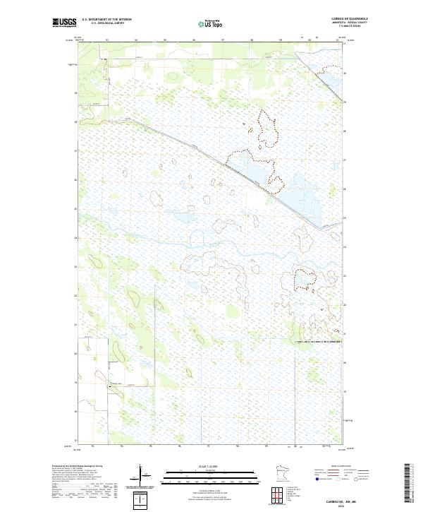
1966 Caribou NE
Roseau County, MN
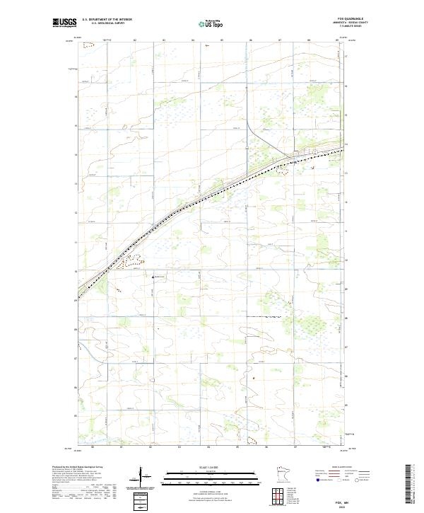
1966 Fox
Roseau County, MN
1966 Haug
Roseau County, MN
1966 Leo
Roseau County, MN

1966 Malung
Roseau County, MN
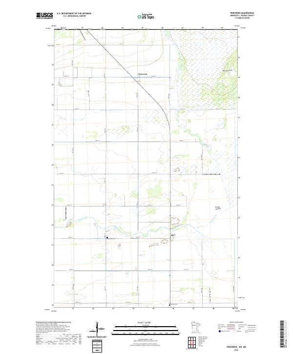
1966 Pinecreek
Roseau County, MN
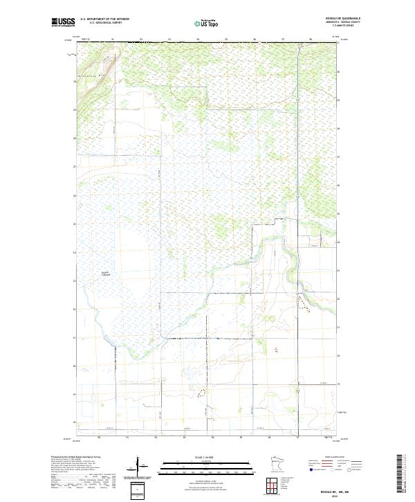
1966 Roseau NE
Roseau County, MN
1966 Salol NE
Roseau County, MN
1966 Salol NW
Roseau County, MN
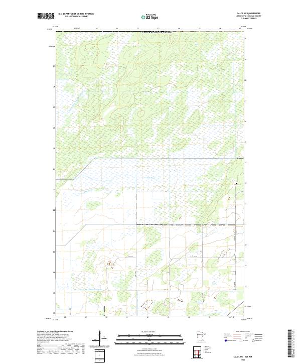
1966 Salol
Roseau County, MN
1967 Swift
Roseau County, MN
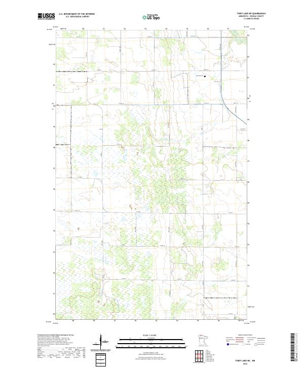
1967 Thief Lake NE
Roseau County, MN
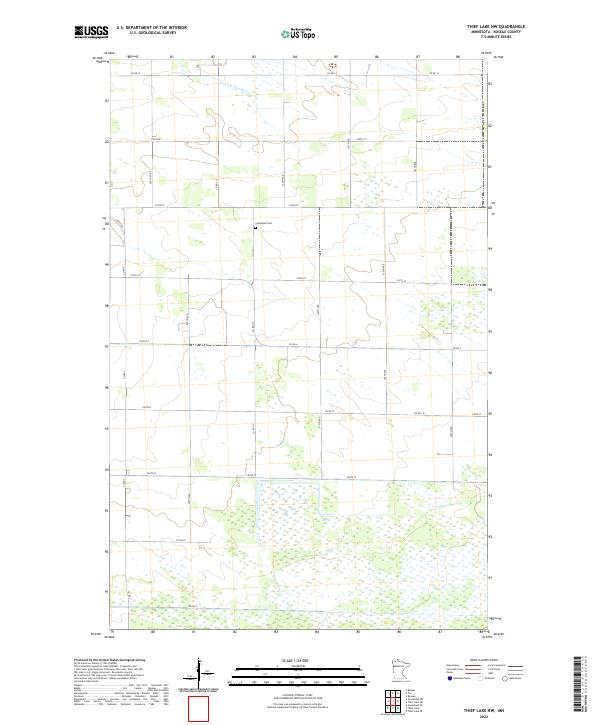
1967 Thief Lake NW
Roseau County, MN
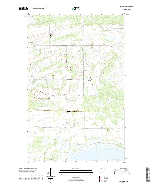
1967 Thief Lake
Roseau County, MN
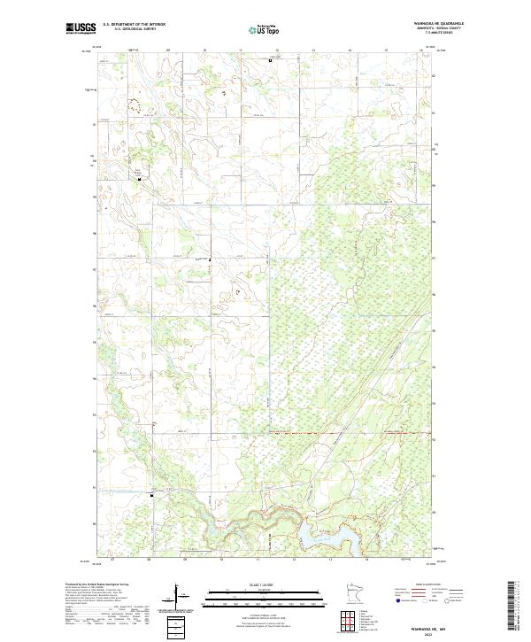
1967 Wannaska NE
Roseau County, MN
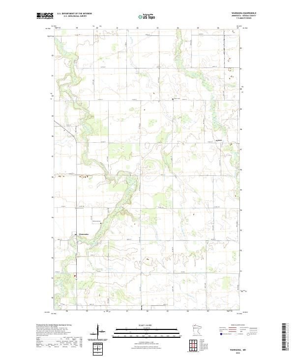
1967 Wannaska
Roseau County, MN
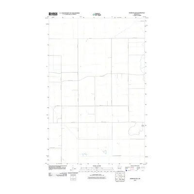
1967 Warroad NW
Roseau County, MN
1967 Warroad SE
Roseau County, MN
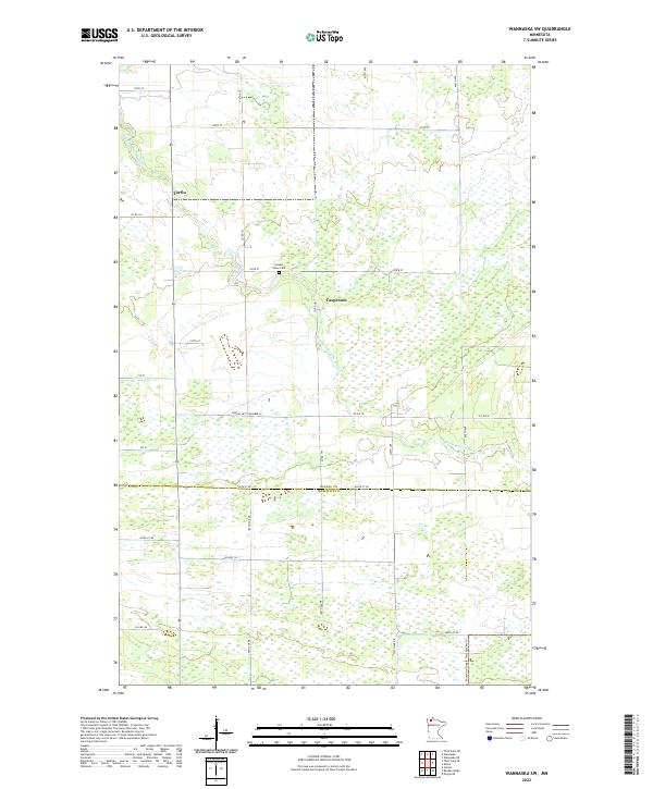
1967 Warroad SW
Roseau County, MN
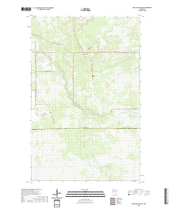
1968 Mulligan Lake NW
Roseau County, MN
1968 Mulligan Lake SW
Roseau County, MN
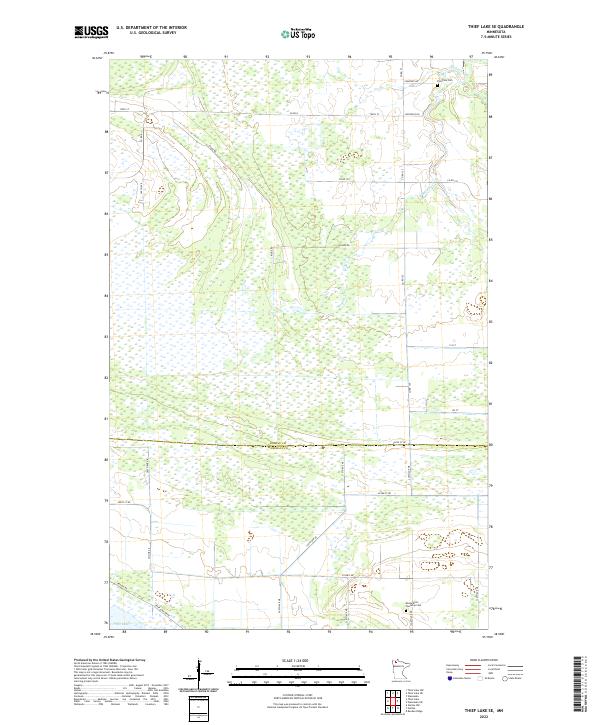
1968 Thief Lake SE
Roseau County, MN
1968 Wannaska SW
Roseau County, MN
1969 Skime
Roseau County, MN
1982 Pelan NE
Roseau County, MN
1982 Pelan SE
Roseau County, MN
2010 Badger NE
Roseau County, MN
2010 Badger NW
Roseau County, MN
2010 Fox
Roseau County, MN
2010 Greenbush NE
Roseau County, MN
2010 Greenbush SE
Roseau County, MN
2010 Haug
Roseau County, MN
2010 Leo
Roseau County, MN
2010 Malung
Roseau County, MN
2010 Mulligan Lake NW
Roseau County, MN
2010 Mulligan Lake SW
Roseau County, MN
2010 Pelan NE
Roseau County, MN
2010 Pelan SE
Roseau County, MN
2010 Pinecreek
Roseau County, MN
2010 Roseau NE
Roseau County, MN
2010 Salol NE
Roseau County, MN
2010 Salol NW
Roseau County, MN
2010 Salol
Roseau County, MN
2010 Skime
Roseau County, MN
2010 Swift
Roseau County, MN
2010 Thief Lake NE
Roseau County, MN
2010 Thief Lake NW
Roseau County, MN
2010 Thief Lake
Roseau County, MN
2010 Thief Lake SE
Roseau County, MN
2010 Wannaska NE
Roseau County, MN
2010 Wannaska
Roseau County, MN
2010 Wannaska SW
Roseau County, MN
2010 Warroad NW
Roseau County, MN
2010 Warroad SE
Roseau County, MN
2010 Warroad SW
Roseau County, MN
2011 Caribou NE
Roseau County, MN
2013 Badger NE OE N
Roseau County, MN
2013 Badger NE
Roseau County, MN
2013 Badger NW
Roseau County, MN
2013 Caribou NE OE N
Roseau County, MN
2013 Caribou NE
Roseau County, MN
2013 Fox
Roseau County, MN
2013 Greenbush NE
Roseau County, MN
2013 Greenbush SE
Roseau County, MN
2013 Haug
Roseau County, MN
2013 Leo
Roseau County, MN
2013 Malung
Roseau County, MN
2013 Mulligan Lake NW
Roseau County, MN
2013 Mulligan Lake SW
Roseau County, MN
2013 Pelan NE
Roseau County, MN
2013 Pelan SE
Roseau County, MN
2013 Pinecreek OE N
Roseau County, MN
2013 Pinecreek
Roseau County, MN
2013 Roseau NE
Roseau County, MN
2013 Salol NE
Roseau County, MN
2013 Salol NW
Roseau County, MN
2013 Salol
Roseau County, MN
2013 Skime
Roseau County, MN
2013 Swift
Roseau County, MN
2013 Thief Lake NE
Roseau County, MN
2013 Thief Lake NW
Roseau County, MN
2013 Thief Lake
Roseau County, MN
2013 Thief Lake SE
Roseau County, MN
2013 Wannaska NE
Roseau County, MN
2013 Wannaska
Roseau County, MN
2013 Wannaska SW
Roseau County, MN
2013 Warroad NW
Roseau County, MN
2013 Warroad SE
Roseau County, MN
2013 Warroad SW
Roseau County, MN
2016 Badger NE OE N
Roseau County, MN
2016 Badger NE
Roseau County, MN
2016 Badger NW
Roseau County, MN
2016 Caribou NE OE N
Roseau County, MN
2016 Caribou NE
Roseau County, MN
2016 Fox
Roseau County, MN
2016 Greenbush NE
Roseau County, MN
2016 Greenbush SE
Roseau County, MN
2016 Haug
Roseau County, MN
2016 Leo
Roseau County, MN
2016 Malung
Roseau County, MN
2016 Mulligan Lake NW
Roseau County, MN
2016 Mulligan Lake SW
Roseau County, MN
2016 Pelan NE
Roseau County, MN
2016 Pelan SE
Roseau County, MN
2016 Pinecreek OE N
Roseau County, MN
2016 Pinecreek
Roseau County, MN
2016 Roseau NE
Roseau County, MN
2016 Salol NE
Roseau County, MN
2016 Salol NW
Roseau County, MN
2016 Salol
Roseau County, MN
2016 Skime
Roseau County, MN
2016 Swift
Roseau County, MN
2016 Thief Lake NE
Roseau County, MN
2016 Thief Lake NW
Roseau County, MN
2016 Thief Lake
Roseau County, MN
2016 Thief Lake SE
Roseau County, MN
2016 Wannaska NE
Roseau County, MN
2016 Wannaska
Roseau County, MN
2016 Wannaska SW
Roseau County, MN
2016 Warroad NW
Roseau County, MN
2016 Warroad SE
Roseau County, MN
2016 Warroad SW
Roseau County, MN
2019 Badger NE
Roseau County, MN
2019 Badger NW
Roseau County, MN
2019 Caribou NE
Roseau County, MN
2019 Fox
Roseau County, MN
2019 Greenbush NE
Roseau County, MN
2019 Greenbush SE
Roseau County, MN
2019 Haug
Roseau County, MN
2019 Leo
Roseau County, MN
2019 Malung
Roseau County, MN
2019 Mulligan Lake NW
Roseau County, MN
2019 Mulligan Lake SW
Roseau County, MN
2019 Pelan NE
Roseau County, MN
2019 Pelan SE
Roseau County, MN
2019 Pinecreek
Roseau County, MN
2019 Roseau NE
Roseau County, MN
2019 Salol NE
Roseau County, MN
2019 Salol NW
Roseau County, MN
2019 Salol
Roseau County, MN
2019 Skime
Roseau County, MN
2019 Swift
Roseau County, MN
2019 Thief Lake NE
Roseau County, MN
2019 Thief Lake NW
Roseau County, MN
2019 Thief Lake
Roseau County, MN
2019 Thief Lake SE
Roseau County, MN
2019 Wannaska NE
Roseau County, MN
2019 Wannaska
Roseau County, MN
2019 Wannaska SW
Roseau County, MN
2019 Warroad NW
Roseau County, MN
2019 Warroad SE
Roseau County, MN
2019 Warroad SW
Roseau County, MN
2022 Badger NE
Roseau County, MN
2022 Badger NW
Roseau County, MN
2022 Caribou NE OE N
Roseau County, MN
2022 Caribou NE
Roseau County, MN
2022 Fox
Roseau County, MN
2022 Greenbush NE
Roseau County, MN
2022 Greenbush SE
Roseau County, MN
2022 Haug
Roseau County, MN
2022 Leo
Roseau County, MN
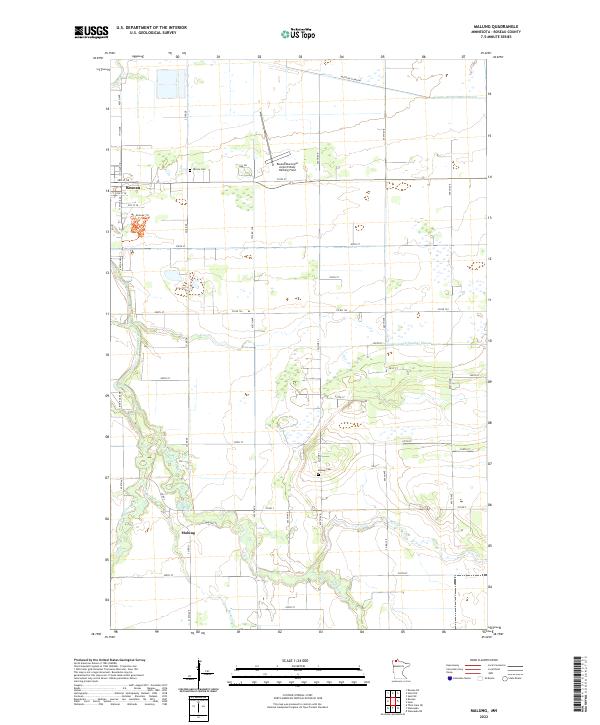
2022 Malung
Roseau County, MN
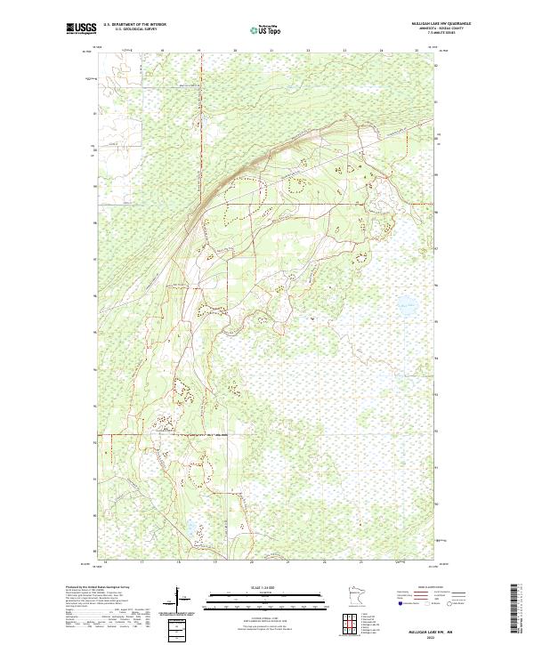
2022 Mulligan Lake NW
Roseau County, MN
2022 Mulligan Lake SW
Roseau County, MN
2022 Pelan NE
Roseau County, MN
2022 Pelan SE
Roseau County, MN
2022 Pinecreek
Roseau County, MN
2022 Roseau NE
Roseau County, MN
2022 Salol NE
Roseau County, MN
2022 Salol NW
Roseau County, MN
2022 Salol
Roseau County, MN
2022 Skime
Roseau County, MN
2022 Swift
Roseau County, MN
2022 Thief Lake NE
Roseau County, MN
2022 Thief Lake NW
Roseau County, MN
2022 Thief Lake
Roseau County, MN
2022 Thief Lake SE
Roseau County, MN
2022 Wannaska NE
Roseau County, MN
2022 Wannaska
Roseau County, MN
2022 Wannaska SW
Roseau County, MN
2022 Warroad NW
Roseau County, MN
2022 Warroad SE
Roseau County, MN
2022 Warroad SW
Roseau County, MN