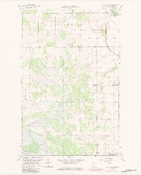
1967 Map of Thief Lake NE
USGS Topo · Published 1984About this map
Nereson State Wildlife Management Area dominates the marshy landscape of this Roseau County quadrant, illustrating the vast wetland conservation efforts in Northern Minnesota during the late 1960s. The terrain is defined by the slow-moving Roseau River and its South Fork Roseau R, which carve through a network of drainage ditches and low-lying brush. Small rural clusters like Stafford and Poplar Grove mark the scattered settlement pattern of the era, where agricultural life centered around community landmarks like Palmville Ch and the Oak Hill Cem. The inclusion of several Gravel Pit sites suggests a local economy tied to road maintenance and regional infrastructure. This map reveals a specific moment before later 1980s updates, preserving the original township boundaries of Stafford, Grimstad, and Palmville alongside the extensive drainage systems required to manage the northern plains water table.
Find a feature on this map
13 named features on this map. Tap any name to fly to it.
Don’t see what you’re looking for? This feature index may not catch every label — zoom into the map to look around manually.
Map Details
Editions of this 1967 Thief Lake NE Map
2 editions found
Other maps of this area

1918 · Goos
USGS Topo · 1:62,500

1918 · Pencer
USGS Topo · 1:62,500

1918 · Roseau
USGS Topo · 1:62,500

1918 · Garland
USGS Topo · 1:62,500

1943 · Goos
USGS Topo · 1:62,500

1954 · Roseau
USGS Topo · 1:250,000

1957 · Roseau
USGS Topo · 1:250,000

1958 · Roseau
USGS Topo · 1:250,000
1966 · Fox
USGS Topo · 1:24,000

1966 · Malung
USGS Topo · 1:24,000