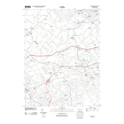
2010 Map of Malvern
USGS Topo · Published 2010About this map
Historic Yellow Springs and the village of Pikeland anchor the northwestern reaches of this Chester County landscape, where the terrain is defined by the winding course of Pickering Creek and the Pickering Creek Reservoir. The suburban and semi-rural transition of the early 21st century is evident in the cluster of residential developments like Charlestown Hunt and Willborne Acres, juxtaposed against established institutional sites and memorial landmarks. Notable aviation and community history is marked by the presence of the Main Line Airport and the expansive Paoli Memorial Grounds near Malvern. The network of local roads, such as Chester Springs Rd and Swedesford Rd, connects numerous small settlements and crossroads like Devault, Sidley, and Bacton, reflecting a long-standing pattern of Pennsylvania piedmont settlement that remains visible even as regional infrastructure like the Pennsylvania Turnpike Interchange 15 has expanded.
Find a feature on this map
126 named features on this map. Tap any name to fly to it.
Don’t see what you’re looking for? This feature index may not catch every label — zoom into the map to look around manually.
Map Details
Editions of this 2010 Malvern Map
This is the sole edition of this map. No revisions or reprints were ever made.
Other maps of this area

1894 · Chester
USGS Topo · 1:62,500

1894 · Norristown
USGS Topo · 1:62,500

1895 · Norristown
USGS Topo · 1:62,500

1896 · Norristown
USGS Topo · 1:62,500

1896 · Chester
USGS Topo · 1:62,500

1898 · Chester
USGS Topo · 1:62,500

1901 · Camden
USGS Topo · 1:125,000

1901 · West Chester
USGS Topo · 1:62,500

1904 · West Chester
USGS Topo · 1:62,500

1906 · Phoenixville
USGS Topo · 1:62,500
Featured Places
- West Goshen Township, PA
- Phoenixville, PA
- Willistown Township, PA
- Charlestown Township, PA
- West Pikeland Township, PA