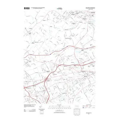
2013 Map of Malvern
USGS Topo · Published 2013About this map
Malvern and its surrounding townships showcase a dense suburban landscape in eastern Pennsylvania, where modern development closely follows the lines of early turnpikes and rail corridors. The map highlights the significant institutional presence in the region, including Immaculata College and the Brwyn Mawr Rehab Ctr, alongside expansive recreation sites like the Chester Valley Golf Course and Hersheys Mill Golf Course. The terrain is shaped by the winding paths of Pickering Cr and Valley Cr, which flow through historic areas such as Historic Yellow Springs and the Pickering Creek Reservoir.
Find a feature on this map
396 named features on this map. Tap any name to fly to it.
Don’t see what you’re looking for? This feature index may not catch every label — zoom into the map to look around manually.
Map Details
Editions of this 2013 Malvern Map
This is the sole edition of this map. No revisions or reprints were ever made.
Other maps of this area

1894 · Chester
USGS Topo · 1:62,500

1894 · Norristown
USGS Topo · 1:62,500

1895 · Norristown
USGS Topo · 1:62,500

1896 · Norristown
USGS Topo · 1:62,500

1896 · Chester
USGS Topo · 1:62,500

1898 · Chester
USGS Topo · 1:62,500

1901 · Camden
USGS Topo · 1:125,000

1901 · West Chester
USGS Topo · 1:62,500

1904 · West Chester
USGS Topo · 1:62,500

1906 · Phoenixville
USGS Topo · 1:62,500
Featured Places
- West Goshen Township, PA
- Phoenixville, PA
- Willistown Township, PA
- Charlestown Township, PA
- West Pikeland Township, PA