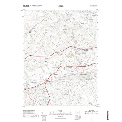
2019 Map of Malvern
USGS Topo · Published 2019About this map
Malvern and its surrounding Chester County countryside are defined by a dense network of suburban development and historical institutions in this modern survey. The map details the educational hubs at Immaculata University and Penn State Great Valley, while also identifying numerous religious and genealogical landmarks such as the Saint Peters Church in the Great Valley Cemetery and the Ebenezer African Methodist Episcopal Cemetery. The landscape transitions from the residential areas of Fraser and Devault to the prominent heights of Diamond Rock Hill. Many small cemeteries and family plots are preserved here, including the Fahnestock Family Burial Ground and the Charlestown Presbyterian Graveyard. Waterways like Pickering Creek and Valley Creek thread through the hills, which remain punctuated by the legacy of local industry seen in features like Wheatley Mine Run.
Find a feature on this map
76 named features on this map. Tap any name to fly to it.
Don’t see what you’re looking for? This feature index may not catch every label — zoom into the map to look around manually.
Map Details
Editions of this 2019 Malvern Map
This is the sole edition of this map. No revisions or reprints were ever made.
Other maps of this area

1894 · Chester
USGS Topo · 1:62,500

1894 · Norristown
USGS Topo · 1:62,500

1895 · Norristown
USGS Topo · 1:62,500

1896 · Norristown
USGS Topo · 1:62,500

1896 · Chester
USGS Topo · 1:62,500

1898 · Chester
USGS Topo · 1:62,500

1901 · Camden
USGS Topo · 1:125,000

1901 · West Chester
USGS Topo · 1:62,500

1904 · West Chester
USGS Topo · 1:62,500

1906 · Phoenixville
USGS Topo · 1:62,500
Featured Places
- West Goshen Township, PA
- Phoenixville, PA
- Willistown Township, PA
- Charlestown Township, PA
- West Pikeland Township, PA