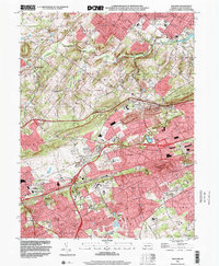
1999 Map of Malvern
USGS Topo · Published 2001About this map
Malvern and its surrounding townships in Chester County are defined by a complex intersection of historic transit routes and burgeoning educational and religious institutions at the close of the twentieth century. The landscape is bisected by the Pennsylvania Turnpike and the busy rail corridors of Amtrak and Norfolk Southern, which connect older nodes like Exton and Frazer. The transition from agrarian roots to suburban development is evident in the presence of the Hershey Mill and a Former Mine near Bacton, set against modern landmarks such as Immaculata College and the Philadelphia Memorial Park.
Find a feature on this map
73 named features on this map. Tap any name to fly to it.
Don’t see what you’re looking for? This feature index may not catch every label — zoom into the map to look around manually.
Map Details
Editions of this 1999 Malvern Map
This is the sole edition of this map. No revisions or reprints were ever made.
Other maps of this area

1894 · Chester
USGS Topo · 1:62,500

1894 · Norristown
USGS Topo · 1:62,500

1895 · Norristown
USGS Topo · 1:62,500

1896 · Norristown
USGS Topo · 1:62,500

1896 · Chester
USGS Topo · 1:62,500

1898 · Chester
USGS Topo · 1:62,500

1901 · Camden
USGS Topo · 1:125,000

1901 · West Chester
USGS Topo · 1:62,500

1904 · West Chester
USGS Topo · 1:62,500

1906 · Phoenixville
USGS Topo · 1:62,500
Featured Places
- West Goshen Township, PA
- Phoenixville, PA
- Willistown Township, PA
- Charlestown Township, PA
- West Pikeland Township, PA