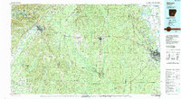
1985 Map of Malvern
USGS Topo · Published 1988About this map
Pine Bluff Arsenal sits prominently along the Arkansas River in this mid-1980s look at central Arkansas. The landscape is defined by the convergence of major transportation corridors and river systems, including the Saline River and Ouachita River. Regional centers like Malvern and Sheridan serve as anchors for a network of smaller communities such as Prattsville, Poyen, and Donaldson.
Find a feature on this map
78 named features on this map. Tap any name to fly to it.
Don’t see what you’re looking for? This feature index may not catch every label — zoom into the map to look around manually.
Map Details
Editions of this 1985 Malvern Map
2 editions found
Other maps of this area

1890 · Benton
USGS Topo · 1:125,000

1890 · Hot Springs
USGS Topo · 1:125,000

1891 · Little Rock
USGS Topo · 1:125,000

1893 · Little Rock
USGS Topo · 1:125,000

1894 · Hot Springs
USGS Topo · 1:125,000

1894 · Benton
USGS Topo · 1:125,000

1901 · Gurdon
USGS Topo · 1:125,000

1903 · Camden
USGS Topo · 1:125,000

1932 · Pastoria
USGS Topo · 1:62,500

1935 · Alexander
USGS Topo · 1:48,000