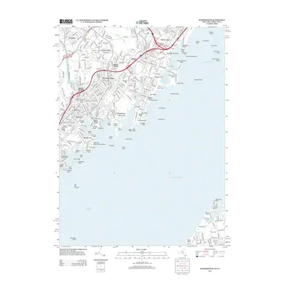
2013 Map of Mamaroneck
USGS Topo · Published 2013About this map
Long Island Sound and its complex coastline define this coastal Westchester County landscape, where tidal inlets and rocky points meet established residential enclaves. Inland, the Metro-North Railroad and the Hutchinson River Pkwy S carve through neighborhoods like Harbor Heights and Rosedale. The map documents a high density of local heritage sites, including the Old Town of Mamaroneck Cem and Greenwood Union Cem. Along the shore, recreational and maritime landmarks such as Playland Lake, Oakland Beach, and the Boardwalk Pier sit adjacent to Mamaroneck Reservoir. This 2013 survey provides a clear view of the interface between developed suburbs and the sound's natural features, from the Byram Point shoreline to the rocky clusters of Great Captain Rocks and Glover Reef.
Find a feature on this map
299 named features on this map. Tap any name to fly to it.
Don’t see what you’re looking for? This feature index may not catch every label — zoom into the map to look around manually.
Map Details
Editions of this 2013 Mamaroneck Map
This is the sole edition of this map. No revisions or reprints were ever made.
Other maps of this area

1891 · Harlem
USGS Topo · 1:62,500

1892 · Stamford
USGS Topo · 1:62,500

1892 · Tarrytown
USGS Topo · 1:62,500

1893 · Stamford
USGS Topo · 1:62,500

1893 · Tarrytown
USGS Topo · 1:62,500

1897 · Harlem
USGS Topo · 1:62,500

1897 · Oyster Bay
USGS Topo · 1:62,500

1898 · Harlem
USGS Topo · 1:62,500

1898 · Oyster Bay
USGS Topo · 1:62,500

1899 · Stamford
USGS Topo · 1:62,500