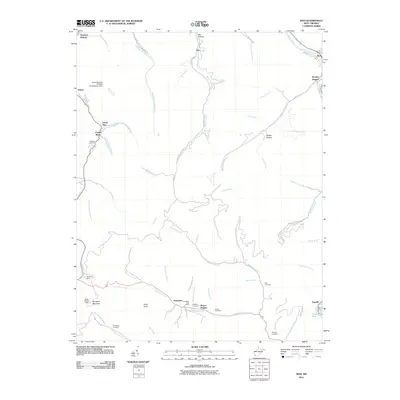
2011 Map of Man
USGS Topo · Published 2011About this map
The Guyandotte River cuts through the northeast and southeast corners of this West Virginia terrain, anchoring a landscape defined by deep-set hollows and industrial footprints. In the early 21st century, the coal heritage of Logan County remains visible through infrastructure like the Stirrat Number 15 Waste Embankment Dam near Stirrat. Local genealogy is well-represented by several family-named landmarks, including multiple locations of the Hatfield Cemetery, reflecting the region’s deep ancestral roots. Small communities and named settlements such as Sarah Ann, Crystal Block, and Sharon Heights follow the narrow valleys of Island Creek and Horsepen Creek. Elevated features like Horsepen Mountain and Coon Knob tower over the branching creek networks, while the Mingo Lookout Tower stands as a sentinel over the southern ridges near the Hampden Post Office.
Find a feature on this map
65 named features on this map. Tap any name to fly to it.
Don’t see what you’re looking for? This feature index may not catch every label — zoom into the map to look around manually.
Map Details
Editions of this 2011 Man Map
This is the sole edition of this map. No revisions or reprints were ever made.
Other maps of this area

1887 · Warfield
USGS Topo · 1:125,000

1891 · Oceana
USGS Topo · 1:125,000

1891 · Warfield
USGS Topo · 1:125,000

1893 · Oceana
USGS Topo · 1:125,000

1898 · Oceana
USGS Topo · 1:125,000

1909 · Matewan
USGS Topo · 1:48,000

1909 · Gilbert
USGS Topo · 1:48,000

1910 · Holden
USGS Topo · 1:48,000

1912 · Gilbert
USGS Topo · 1:62,500

1912 · Holden
USGS Topo · 1:62,500