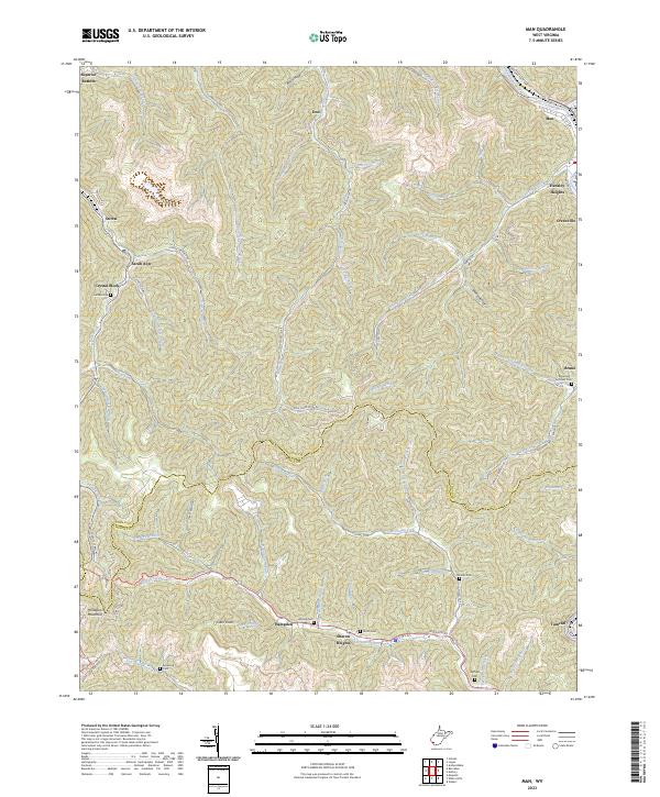
2023 Map of Man
USGS Topo · Published 2023About this map
The Guyandotte River cuts through the northeast corner of this map, anchoring the town of Man, while the rugged southern border marks the divide between Logan and Mingo Counties. This region is characterized by a dense network of mountain hollows and branches, where settlements like Sarah Ann, Stirrat, and Crystal Block follow the winding course of Island Creek. The landscape reflects a deep-rooted local history, evidenced by several family burial grounds including two distinct locations for Hatfield Cem and the Browning-Grimmet Cem near Bruno. Along the southern edge, US Rte 52 connects Hampden and Sharon Heights as it traverses the heights near Horsepen Mountain. The intricate drainage patterns of Browning Fork and Sandlick Creek illustrate the topographic complexity that has long dictated the placement of roads and communities throughout the coalfields.
Find a feature on this map
76 named features on this map. Tap any name to fly to it.
Don’t see what you’re looking for? This feature index may not catch every label — zoom into the map to look around manually.
Map Details
Editions of this 2023 Man Map
This is the sole edition of this map. No revisions or reprints were ever made.
Other maps of this area

1887 · Warfield
USGS Topo · 1:125,000

1891 · Oceana
USGS Topo · 1:125,000

1891 · Warfield
USGS Topo · 1:125,000

1893 · Oceana
USGS Topo · 1:125,000

1898 · Oceana
USGS Topo · 1:125,000

1909 · Matewan
USGS Topo · 1:48,000

1909 · Gilbert
USGS Topo · 1:48,000

1910 · Holden
USGS Topo · 1:48,000

1912 · Gilbert
USGS Topo · 1:62,500

1912 · Holden
USGS Topo · 1:62,500