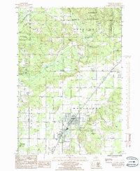
1985 Map of Mancelona
USGS Topo · Published 1986About this map
The northern Michigan village of Mancelona serves as the central hub of this mid-1980s survey, surrounded by the dense timberlands of the Mackinaw State Forest. The map documents a landscape defined by its glacial history and industrial legacy, featuring a series of kettle lakes such as Nelson Lake, Peckham Lake, and Tar Lake southwest of the main settlement. Evidence of the region's logging and transit history is visible in the Old R R Grade cutting through the terrain near Wetzel, while modern infrastructure like the Municipal Airport and a series of regional pipelines mark the era's development. The land transitions from the organized grid of the Mancelona streets and the nearby community of Antrim to the high ground of Chestonia and Mount Bundy, showcasing the balance between small-town Michigan life and the vast wooded tracts of Antrim Co.
Find a feature on this map
34 named features on this map. Tap any name to fly to it.
Don’t see what you’re looking for? This feature index may not catch every label — zoom into the map to look around manually.
Map Details
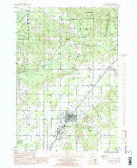
Editions of this 1985 Mancelona Map
2 editions found
Other maps of this area

1954 · Traverse City
USGS Topo · 1:250,000

1955 · Cheboygan
USGS Topo · 1:250,000

1956 · Alba
USGS Topo · 1:62,500

1956 · Mancelona
USGS Topo · 1:62,500

1958 · Cheboygan
USGS Topo · 1:250,000

1958 · Traverse City
USGS Topo · 1:250,000

1961 · Boyne Falls
USGS Topo · 1:62,500

1961 · Boyne City
USGS Topo · 1:62,500

1975 · Mancelona NE
USGS Topo · 1:24,000

1975 · Mancelona NW
USGS Topo · 1:24,000
Featured Places
- Mancelona, Mancelona Township
- Chestonia Township, MI
- Kearney Township, MI
- Wetzel, Mancelona Township
- Mancelona Township, MI