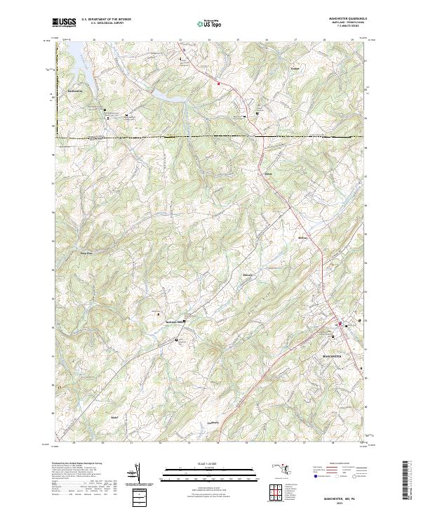
2023 Map of Manchester
USGS Topo · Published 2023About this map
Manchester and its surrounding countryside along the Maryland and Pennsylvania border reveal a landscape defined by traditional crossroads settlements and long-standing congregational centers. This modern topographic record traces the complex headwaters of the region, where Big Pipe Creek and the South Branch Gunpowder Falls begin their descent through the rolling terrain. The map is particularly valuable for genealogical research, documenting numerous burial sites such as the Blocher Monument Graveyard and Saint Bartholomews Church Cem - Old. The prominent Dug Hill Ridge serves as a geographic spine between the small communities of Ebbvale, Melrose, and Bachman Mills. From the early meeting houses like Wentz Meeting House to the industrial roots at Bachman Mills, the map illustrates a transition from historic agricultural hamlets to contemporary residential patterns while preserving the locations of ancestral landmarks like Martin Spring.
Find a feature on this map
151 named features on this map. Tap any name to fly to it.
Don’t see what you’re looking for? This feature index may not catch every label — zoom into the map to look around manually.
Map Details
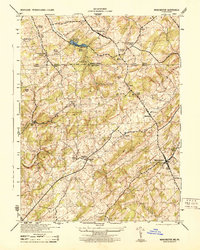
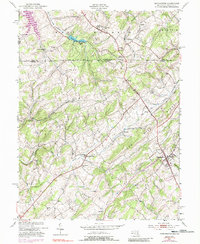
Editions of this 2023 Manchester Map
This is the sole edition of this map. No revisions or reprints were ever made.
Historical Maps of Oakleigh Ridge Through Time
3 maps found
Featured Locations
- Manchester, MD
- Oakleigh Ridge, MD
- Rarjem Acres, MD
- Sterner Heights Estates, MD
- West Manheim Township, PA