
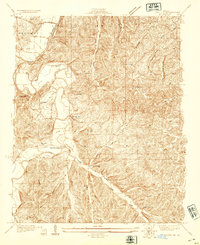
1931 Map of Manchester SE
USGS Topo · Published 1931About this map
The Meramec River winds through the heart of this 1931 survey, shaping the development of St. Louis County just before significant post-war expansion. Along its banks, the planned resort community of Times Beach is visible in its early grid layout, adjacent to the rail-oriented settlements of Eureka and Glencoe. This era captures a landscape defined by two major rail lines, the Missouri Pacific and the St Louis and San Francisco, which dictated the growth of towns like Valley Park and Crescent.
Find a feature on this map
56 named features on this map. Tap any name to fly to it.
Don’t see what you’re looking for? This feature index may not catch every label — zoom into the map to look around manually.
Map Details
Editions of this 1931 Manchester SE Map
This is the sole edition of this map. No revisions or reprints were ever made.
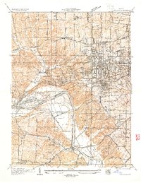
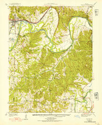
Other maps of this area

1901 · De Soto
USGS Topo · 1:125,000

1903 · O'Fallon
USGS Topo · 1:125,000

1912 · Kimmswick
USGS Topo · 1:62,500

1916 · Kimmswick
USGS Topo · 1:62,500
1931 · Pacific NE
USGS Topo · 1:24,000

1932 · Manchester NE
USGS Topo · 1:24,000

1933 · Creve Coeur
USGS Topo · 1:24,000
1933 · Kirkwood
USGS Topo · 1:24,000
1937 · Pacific
USGS Topo · 1:24,000

1937 · Weldon Spring
USGS Topo · 1:24,000