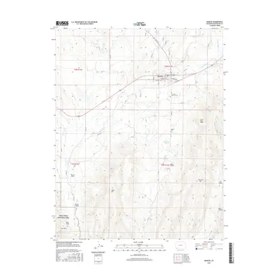
2016 Map of Mancos
USGS Topo · Published 2016About this map
Mancos occupies the high plateau where the Mancos River emerges from its mountain headwaters, serving as a gateway to the southwest’s dramatic canyon country. The landscape transitions sharply from the agricultural Mancos Valley to the uplifted terrain of Weber Mtn and Menefee Mtn. The southern reaches of the map include the protected boundary of Mesa Verde National Park, featuring the East Rim and the descent into Mancos Canyon. Genealogists and local historians can locate early burial sites at Cedar Grove Cem and Webber Cem, both situated near the town center. The presence of the Lower Weber Reservoir and various creeks like Chicken Cr and W Fork Mud Cr highlight the critical role of water management in this arid Colorado environment during the 2010s.
Find a feature on this map
66 named features on this map. Tap any name to fly to it.
Don’t see what you’re looking for? This feature index may not catch every label — zoom into the map to look around manually.
Map Details
Editions of this 2016 Mancos Map
This is the sole edition of this map. No revisions or reprints were ever made.
Other maps of this area

1895 · La Plata
USGS Topo · 1:62,500

1897 · La Plata
USGS Topo · 1:62,500

1899 · La Plata
USGS Topo · 1:62,500

1908 · La Plata
USGS Topo · 1:62,500

1912 · Soda Canyon
USGS Topo · 1:62,500

1913 · Red Mesa
USGS Topo · 1:62,500

1915 · Soda Canyon
USGS Topo · 1:62,500

1956 · Cortez
USGS Topo · 1:250,000

1958 · Cortez
USGS Topo · 1:250,000

1959 · Cortez
USGS Topo · 1:250,000