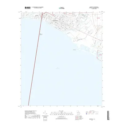
2018 Map of Mandeville
USGS Topo · Published 2018About this map
Mandeville and the adjacent settlement of Lewisburg occupy the northern shore of Lake Pontchartrain on this 2018 survey. The landscape is defined by the extensive wetland network where numerous waterways, including Bayou Chinchuba, Bayou Castine, and Cane Bayou, drain into the lake. A significant engineering landmark, the Lake Pontchartrain Causeway, originates here, extending southward across the water. The town grid reflects its long-standing development, with historical burial grounds at Mandeville Cem and a dense network of streets like Orleans St and Lafayette St that follow the shoreline. East of the main settlement, the terrain transitions into more preserved marshlands near Green Point and the winding reaches of Little Bayou Castine, illustrating the persistent coastal geography of St. Tammany Parish.
Find a feature on this map
87 named features on this map. Tap any name to fly to it.
Don’t see what you’re looking for? This feature index may not catch every label — zoom into the map to look around manually.
Map Details
Editions of this 2018 Mandeville Map
This is the sole edition of this map. No revisions or reprints were ever made.
Other maps of this area

1891 · Spanish Fort
USGS Topo · 1:62,500

1892 · Chef Menteur
USGS Topo · 1:62,500

1935 · Slidell
USGS Topo · 1:62,500

1935 · Covington
USGS Topo · 1:62,500

1936 · South Point
USGS Topo · 1:31,680

1936 · Chef Menteur
USGS Topo · 1:62,500

1936 · Spanish Fort
USGS Topo · 1:62,500

1939 · Slidell
USGS Topo · 1:62,500

1939 · Covington
USGS Topo · 1:62,500

1950 · Slidell
USGS Topo · 1:62,500