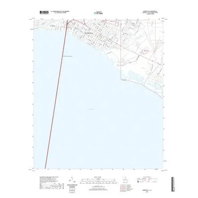
2020 Map of Mandeville
USGS Topo · Published 2020About this map
Mandeville and the adjacent settlement of Lewisburg sit along the northern shore of Lake Pontchartrain, where the iconic Lake Pontchartrain Causeway makes landfall. This 2020 survey illustrates the town's grid reaching toward the water, bounded by natural waterways such as Bayou Chinchuba to the west and Bayou Castine to the east. The map provides clear detail for local historians, showing the location of the Mandeville Cem and the complex network of residential streets that have filled in the area between the shore and the inland marshes. Further east, the landscape transitions to the wetlands around Little Bayou Castine and Cane Bayou, leading toward the distinct coastal feature at Green Point.
Find a feature on this map
86 named features on this map. Tap any name to fly to it.
Don’t see what you’re looking for? This feature index may not catch every label — zoom into the map to look around manually.
Map Details
Editions of this 2020 Mandeville Map
This is the sole edition of this map. No revisions or reprints were ever made.
Other maps of this area

1891 · Spanish Fort
USGS Topo · 1:62,500

1892 · Chef Menteur
USGS Topo · 1:62,500

1935 · Slidell
USGS Topo · 1:62,500

1935 · Covington
USGS Topo · 1:62,500

1936 · South Point
USGS Topo · 1:31,680

1936 · Chef Menteur
USGS Topo · 1:62,500

1936 · Spanish Fort
USGS Topo · 1:62,500

1939 · Slidell
USGS Topo · 1:62,500

1939 · Covington
USGS Topo · 1:62,500

1950 · Slidell
USGS Topo · 1:62,500