Loading...
Loading map...2024 Map of Mandeville
USGS Topo · Published 2024About this map
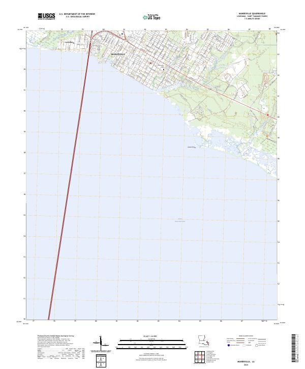
The northern shoreline of Lake Pontchartrain defines this survey of St. Tammany Parish, where the grid of Mandeville meets the intricate wetlands of the Gulf coast. The map illustrates a landscape shaped by its relationship with the water, from the residential streets of Lewisburg and the town center to the vast protected reaches of the Big Branch Marsh National Wildlife Refuge in the southeast.
Find a feature on this map
86 named features on this map. Tap any name to fly to it.
Don’t see what you’re looking for? This feature index may not catch every label — zoom into the map to look around manually.
Map Details
Date Portrayed2024
Date Published2024
PublisherU.S. Geological Survey
Map TypeTopographic
Scale1:24000
Physical Dimensions24 x 29 inches
Editions of this 2024 Mandeville Map
This is the sole edition of this map. No revisions or reprints were ever made.
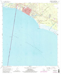
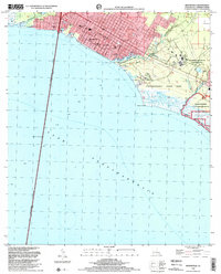
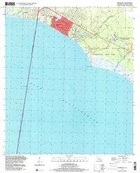
Historical Maps of Castine Point Through Time
4 maps found
Featured Locations
Source Details
SourceU.S. Geological Survey
CopyrightPublic Domain