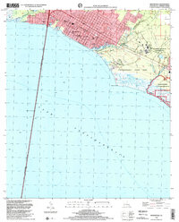
1998 Map of Mandeville
USGS Topo · Published 2001About this map
The Northshore community of Mandeville serves as the centerpiece of this coastal survey, showing the town's extent along the northern rim of Lake Pontchartrain. The urban footprint is anchored by educational and civic institutions like Our Lady of the Lake Sch and Rosenwald Sch, while the landmark Lake Pontchartrain Causeway (Toll) stretches south across the water. To the west, the residential pocket of Lewisburg borders Bayou Chinchuba, illustrating the local dependence on both road and water access.
Find a feature on this map
21 named features on this map. Tap any name to fly to it.
Don’t see what you’re looking for? This feature index may not catch every label — zoom into the map to look around manually.
Map Details
Editions of this 1998 Mandeville Map
This is the sole edition of this map. No revisions or reprints were ever made.
Other maps of this area

1891 · Spanish Fort
USGS Topo · 1:62,500

1892 · Chef Menteur
USGS Topo · 1:62,500

1935 · Slidell
USGS Topo · 1:62,500

1935 · Covington
USGS Topo · 1:62,500

1936 · South Point
USGS Topo · 1:31,680

1936 · Chef Menteur
USGS Topo · 1:62,500

1936 · Spanish Fort
USGS Topo · 1:62,500

1939 · Slidell
USGS Topo · 1:62,500

1939 · Covington
USGS Topo · 1:62,500

1950 · Slidell
USGS Topo · 1:62,500