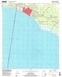
1999 Map of Mandeville
USGS Topo · Published 2000About this map
Mandeville sits on the north shore of Lake Pontchartrain, anchored by its historic grid and the arrival of the Lake Pontchartrain Causeway. This 1999 photo-inspection shows the town as a well-established residential hub, featuring local institutions like the Rosenwald Sch and Our Lady of the Lake Sch. To the west, the community of Lewisburg borders Bayou Chinchuba, while the east is dominated by the sprawling grounds of the Southeast Louisiana State Hospital.
Find a feature on this map
27 named features on this map. Tap any name to fly to it.
Don’t see what you’re looking for? This feature index may not catch every label — zoom into the map to look around manually.
Map Details
Editions of this 1999 Mandeville Map
This is the sole edition of this map. No revisions or reprints were ever made.
Other maps of this area

1891 · Spanish Fort
USGS Topo · 1:62,500

1892 · Chef Menteur
USGS Topo · 1:62,500

1935 · Slidell
USGS Topo · 1:62,500

1935 · Covington
USGS Topo · 1:62,500

1936 · South Point
USGS Topo · 1:31,680

1936 · Chef Menteur
USGS Topo · 1:62,500

1936 · Spanish Fort
USGS Topo · 1:62,500

1939 · Slidell
USGS Topo · 1:62,500

1939 · Covington
USGS Topo · 1:62,500

1950 · Slidell
USGS Topo · 1:62,500