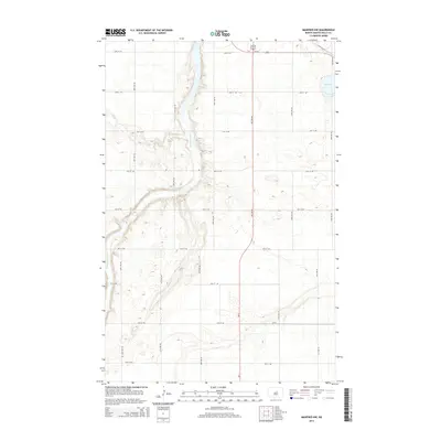
2014 Map of Manfred NW
USGS Topo · Published 2014About this map
The Sheyenne River cuts through the western portion of this Wells County landscape, creating a distinct corridor of elevation change across the prairie. This natural waterway is the primary geographical anchor in an area defined by a strict section-line road grid, including 28th Ave NE and 30th Ave NE. The intersection of modern infrastructure and natural hydrology is evident where the river winds through the terrain, contrasting with the straight paths of ND-3 and Us-52.
Find a feature on this map
22 named features on this map. Tap any name to fly to it.
Don’t see what you’re looking for? This feature index may not catch every label — zoom into the map to look around manually.
Map Details
Editions of this 2014 Manfred NW Map
This is the sole edition of this map. No revisions or reprints were ever made.
Other maps of this area

1940 · Aylmer
USGS Topo · 1:62,500

1941 · Selz
USGS Topo · 1:62,500

1945 · Manfred
USGS Topo · 1:62,500

1946 · Sheyenne Lake
USGS Topo · 1:48,000

1947 · Sheyenne Lake
USGS Topo · 1:62,500

1948 · Manfred
USGS Topo · 1:62,500

1949 · Manfred SW
USGS Topo · 1:24,000

1950 · Manfred SE
USGS Topo · 1:24,000

1950 · Wellsburg
USGS Topo · 1:24,000

1950 · Manfred NW
USGS Topo · 1:24,000