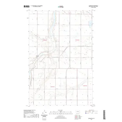
2020 Map of Manfred NW
USGS Topo · Published 2020About this map
The Sheyenne River cuts a prominent winding path through this portion of Wells County, shaping the local topography with its drainage basins and coulees. On the western bluffs overlooking the river valley sits the Cheyenne River Seventh-Day Adventist Cem, a significant site for local genealogical research and religious history. The landscape is characterized by the structured grid of the Public Land Survey System, though this regularity is interrupted by the modern path of the N Country National Scenic Trail as it traverses the terrain. In the northeastern corner, Egg Lake provides a distinct hydrological feature amidst the surrounding prairie. Transportation history is visible through the inclusion of Old Hwy 52, which runs through the southern sections of the township, marking the evolution of regional travel routes alongside the established section-line roads.
Find a feature on this map
19 named features on this map. Tap any name to fly to it.
Don’t see what you’re looking for? This feature index may not catch every label — zoom into the map to look around manually.
Map Details
Editions of this 2020 Manfred NW Map
This is the sole edition of this map. No revisions or reprints were ever made.
Other maps of this area

1940 · Aylmer
USGS Topo · 1:62,500

1941 · Selz
USGS Topo · 1:62,500

1945 · Manfred
USGS Topo · 1:62,500

1946 · Sheyenne Lake
USGS Topo · 1:48,000

1947 · Sheyenne Lake
USGS Topo · 1:62,500

1948 · Manfred
USGS Topo · 1:62,500

1949 · Manfred SW
USGS Topo · 1:24,000

1950 · Manfred SE
USGS Topo · 1:24,000

1950 · Wellsburg
USGS Topo · 1:24,000

1950 · Manfred NW
USGS Topo · 1:24,000