2020 Map of Manfred SW
USGS Topo · Published 2020About this map
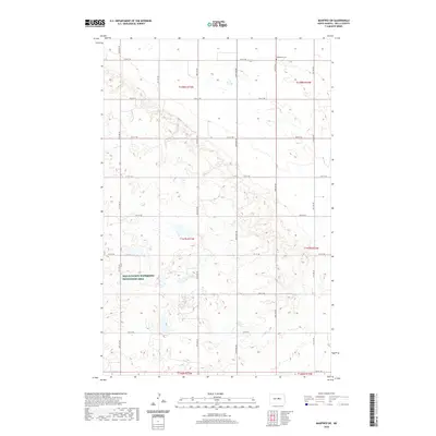
The upper reaches of the James River define the southern edge of this Wells County landscape, characterized by the glacial prairie pothole topography typical of the region. Much of the terrain is defined by protected conservation land, specifically the Wells County Waterfowl Production Area, which preserves critical habitat for migratory birds and local wildlife. Settlement patterns follow a strict section-line road grid, with routes like 26th Ave NE and 14th St NE providing access to the isolated farmsteads and agricultural tracts that dominate the area. In the northeast corner, the Eigenheim Cem serves as a localized genealogical marker, reflecting the area's rural heritage and the small communities that formed around prairie churches. The map illustrates a contemporary balance between intensive agriculture and federal conservation efforts in central North Dakota.
Find a feature on this map
24 named features on this map. Tap any name to fly to it.
Don’t see what you’re looking for? This feature index may not catch every label — zoom into the map to look around manually.
Map Details
Editions of this 2020 Manfred SW Map
This is the sole edition of this map. No revisions or reprints were ever made.
Other maps of this area

1945 · Manfred
USGS Topo · 1:62,500

1946 · Sheyenne Lake
USGS Topo · 1:48,000

1947 · Sheyenne Lake
USGS Topo · 1:62,500

1948 · Manfred
USGS Topo · 1:62,500

1949 · Manfred SW
USGS Topo · 1:24,000

1950 · Manfred SE
USGS Topo · 1:24,000

1950 · Manfred NW
USGS Topo · 1:24,000

1950 · Sheyenne Lake NE
USGS Topo · 1:24,000

1950 · Manfred
USGS Topo · 1:24,000

1950 · Manfred SW
USGS Topo · 1:24,000