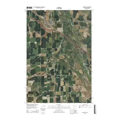
2014 Map of Manhattan
USGS Topo · Published 2014About this map
Manhattan serves as the primary hub of this Gallatin County landscape, situated where the high plains meet the intricate water networks of the Gallatin Valley. The map documents an extensive system of irrigation and water management, featuring prominent infrastructure like the Lowline Canal, White Ditch, and Lewis Overflow, which sustain the agricultural operations surrounding settlements like Amsterdam and Churchill. The Gallatin River winds through the eastern portion of the quadrangle, crossed by several named landmarks including the Kinkle Bridge, Ray Angel Bridge, and Central Park Bridge. Genealogists and local historians can locate the Meadowview Cemetery north of the river, while the presence of smaller locales like White, Buell, and Belgrade Junction illustrates the historic rail and road-based settlement patterns that define this region.
Find a feature on this map
73 named features on this map. Tap any name to fly to it.
Don’t see what you’re looking for? This feature index may not catch every label — zoom into the map to look around manually.
Map Details
Editions of this 2014 Manhattan Map
This is the sole edition of this map. No revisions or reprints were ever made.
Other maps of this area

1888 · Three Forks
USGS Topo · 1:250,000

1894 · Three Forks
USGS Topo · 1:250,000

1895 · Three Forks
USGS Topo · 1:250,000

1947 · Bozeman
USGS Topo · 1:250,000

1948 · Bozeman
USGS Topo · 1:250,000

1949 · Anceney
USGS Topo · 1:62,500

1949 · Manhattan
USGS Topo · 1:62,500

1950 · Belgrade
USGS Topo · 1:62,500

1953 · Bozeman
USGS Topo · 1:62,500

1955 · Bozeman
USGS Topo · 1:250,000