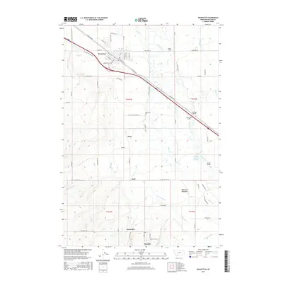
2017 Map of Manhattan
USGS Topo · Published 2017About this map
Manhattan serves as the primary hub of this 2017 survey, situated along a dense network of roads and rail lines that reflect the agricultural and transportation history of Gallatin County. To the south, the settlements of Amsterdam and Churchill sit at the base of the rising plateau, connected by a systematic grid of roads like Churchill Rd. The landscape is defined by the sophisticated irrigation and drainage systems vital to the region, including the Lowline Canal, White Ditch, and Lewis Overflow. These man-made waterways interact with the natural course of the Gallatin River, which is spanned by several named crossings such as the Kinkle Bridge, Ray Angel Bridge, and Central Park Bridge. The presence of the Meadowview Cem and smaller locales like White and Buell suggest a long-established rural community built around the river's fertile valley and the logistical corridor of S Manhattan.
Find a feature on this map
72 named features on this map. Tap any name to fly to it.
Don’t see what you’re looking for? This feature index may not catch every label — zoom into the map to look around manually.
Map Details
Editions of this 2017 Manhattan Map
This is the sole edition of this map. No revisions or reprints were ever made.
Other maps of this area

1888 · Three Forks
USGS Topo · 1:250,000

1894 · Three Forks
USGS Topo · 1:250,000

1895 · Three Forks
USGS Topo · 1:250,000

1947 · Bozeman
USGS Topo · 1:250,000

1948 · Bozeman
USGS Topo · 1:250,000

1949 · Anceney
USGS Topo · 1:62,500

1949 · Manhattan
USGS Topo · 1:62,500

1950 · Belgrade
USGS Topo · 1:62,500

1953 · Bozeman
USGS Topo · 1:62,500

1955 · Bozeman
USGS Topo · 1:250,000