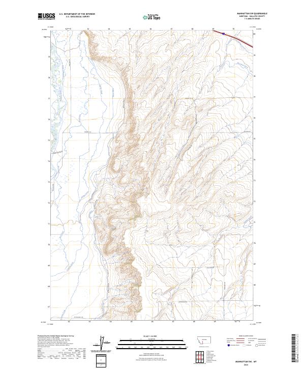
2024 Map of Manhattan SW
USGS Topo · Published 2024About this map
The Madison River corridor defines the western edge of this landscape in Gallatin County, where a complex network of man-made waterways supports the region's agricultural traditions. Extensive irrigation infrastructure, including the Warm Springs Canal and Moreland Ditch in the north, reflects a long-standing reliance on diverted water to cultivate the surrounding plains. The presence of Sloan Ditch and the Lowline Canal further illustrates how the terrain has been engineered for ranching and farming. Local transportation is anchored by a grid of rural routes such as Amsterdam Rd and Grainbelt Rd, which connect the scattered holdings. These roads, including the evocatively named Buffalo Jump Rd, trace the natural contours between the river valley and the higher ground to the east, providing a clear view of the modern land use patterns in this part of Montana.
Find a feature on this map
25 named features on this map. Tap any name to fly to it.
Don’t see what you’re looking for? This feature index may not catch every label — zoom into the map to look around manually.
Map Details
Editions of this 2024 Manhattan SW Map
This is the sole edition of this map. No revisions or reprints were ever made.
Other maps of this area

1888 · Three Forks
USGS Topo · 1:250,000

1894 · Three Forks
USGS Topo · 1:250,000

1895 · Three Forks
USGS Topo · 1:250,000

1947 · Bozeman
USGS Topo · 1:250,000

1948 · Bozeman
USGS Topo · 1:250,000

1949 · Anceney
USGS Topo · 1:62,500

1949 · Manhattan
USGS Topo · 1:62,500

1949 · Norris
USGS Topo · 1:62,500

1950 · Three Forks
USGS Topo · 1:62,500

1951 · Norris
USGS Topo · 1:62,500