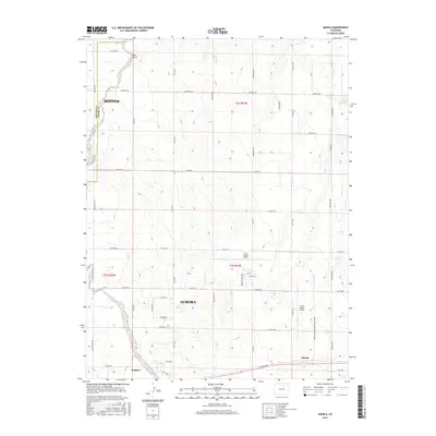
2016 Map of Manila
USGS Topo · Published 2016About this map
Front Range Airport dominates the central landscape of this 2016 survey, serving as a significant logistical hub on the eastern plains near Aurora. The surrounding terrain transitions from the edges of the Denver and Adams county line into a systematic grid of section roads and rural residential developments. Historical transportation corridors like E Colfax Ave and Manilla Rd define the local movement, while small drainage systems including Box Elder Creek, Bear Gulch, and Horse Creek cut through the high plains topography.
Find a feature on this map
42 named features on this map. Tap any name to fly to it.
Don’t see what you’re looking for? This feature index may not catch every label — zoom into the map to look around manually.
Map Details
Editions of this 2016 Manila Map
This is the sole edition of this map. No revisions or reprints were ever made.
Other maps of this area

1890 · East Denver
USGS Topo · 1:125,000

1939 · Coal Creek
USGS Topo · 1:24,000

1942 · Mile High Lakes
USGS Topo · 1:31,680

1942 · Box Elder School
USGS Topo · 1:31,680

1942 · Coal Creek
USGS Topo · 1:31,680

1949 · Sunnydale
USGS Topo · 1:24,000

1949 · Bennett
USGS Topo · 1:24,000

1951 · Manila
USGS Topo · 1:24,000
1952 · Horse Creek
USGS Topo · 1:24,000

1953 · Denver
USGS Topo · 1:250,000