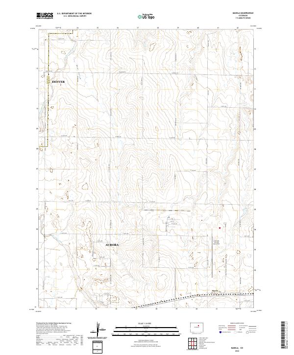
2022 Map of Manila
USGS Topo · Published 2022About this map
Manila and the eastern fringes of Aurora and Denver occupy this transitional landscape where the high plains meet the growing infrastructure of the Front Range. The map is defined by the drainage systems of Box Elder Creek and Horse Cr, alongside the distinct depression of Bear Gulch. A significant portion of the area is dedicated to the Colorado Air and Space Port, which stands as a major modern landmark amidst a grid of long-established section roads like Irondale Rd and Manilla Rd. The road network, including Watkins Rd and Front Range Pkwy, illustrates the steady expansion of suburban and industrial development into formerly rural Adams County territory.
Find a feature on this map
47 named features on this map. Tap any name to fly to it.
Don’t see what you’re looking for? This feature index may not catch every label — zoom into the map to look around manually.
Map Details
Editions of this 2022 Manila Map
This is the sole edition of this map. No revisions or reprints were ever made.
Other maps of this area

1890 · East Denver
USGS Topo · 1:125,000

1939 · Coal Creek
USGS Topo · 1:24,000

1942 · Mile High Lakes
USGS Topo · 1:31,680

1942 · Box Elder School
USGS Topo · 1:31,680

1942 · Coal Creek
USGS Topo · 1:31,680

1949 · Sunnydale
USGS Topo · 1:24,000

1949 · Bennett
USGS Topo · 1:24,000

1951 · Manila
USGS Topo · 1:24,000
1952 · Horse Creek
USGS Topo · 1:24,000

1953 · Denver
USGS Topo · 1:250,000