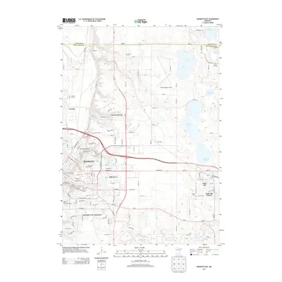
2013 Map of Mankato East
USGS Topo · Published 2013About this map
Mankato and its eastern suburbs serve as the focal point of this regional study, illustrating the dense concentration of educational and civic institutions that define the city. The landscape is marked by prominent campuses such as Minnesota State University-Mankato and Bethany Lutheran Coll, alongside residential expansions like Belle Haven and Knollwood Park. For genealogists and local historians, the sheet is particularly valuable for its documentation of numerous burial grounds, including the Old Masonic Cem, Good Counsel Cem, and the more remote Sugar Grove Cem near the Le Sueur County line.
Find a feature on this map
52 named features on this map. Tap any name to fly to it.
Don’t see what you’re looking for? This feature index may not catch every label — zoom into the map to look around manually.
Map Details
Editions of this 2013 Mankato East Map
This is the sole edition of this map. No revisions or reprints were ever made.
Other maps of this area

1950 · Mankato East
USGS Topo · 1:62,500

1951 · Mankato East
USGS Topo · 1:62,500

1951 · Mankato West
USGS Topo · 1:62,500

1953 · Saint Paul
USGS Topo · 1:250,000

1953 · New Ulm
USGS Topo · 1:250,000

1957 · New Ulm
USGS Topo · 1:250,000

1958 · New Ulm
USGS Topo · 1:250,000

1959 · Saint Paul
USGS Topo · 1:250,000

1965 · Cleveland
USGS Topo · 1:24,000

1965 · North Star
USGS Topo · 1:24,000