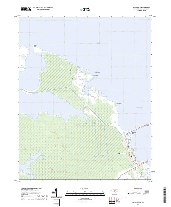
2022 Map of Manns Harbor
USGS Topo · Published 2022About this map
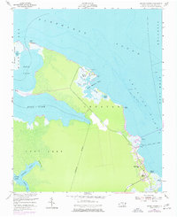
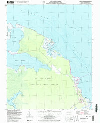
Manns Harbor serves as a critical gateway between the mainland and the Outer Banks, anchored by the infrastructure of the Virginia Dare Memorial Brg and the Manns Harbor Brg. This coastal landscape is defined by the expansive waters of Albemarle Sound and Croatan Sound, which isolate the peninsula of Mashoes and the protected wetlands of Mashoes Marsh. The geography reveals a complex network of estuarine features, including The Frying Pan and Durant Island to the west, and numerous tidal channels such as Poster Gut and Spence Creek. Traces of the area's maritime transit history are evident in the alignment of Old Ferry Dock Rd, pointing to the era before modern bridge spans dominated the crossing. The map details a low-lying environment where land and water blur at Reeds Point and Roanoke Marsh, illustrating the delicate transition between the North Carolina mainland and its sound-side communities.
Find a feature on this map
29 named features on this map. Tap any name to fly to it.
Don’t see what you’re looking for? This feature index may not catch every label — zoom into the map to look around manually.
Map Details
Editions of this 2022 Manns Harbor Map
This is the sole edition of this map. No revisions or reprints were ever made.
Historical Maps of Mashoes Through Time
3 maps found