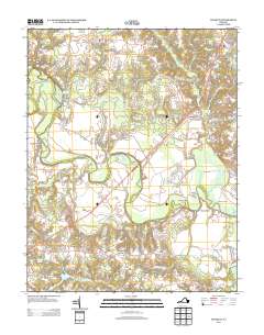
2013 Map of Manquin
USGS Topo · Published 2013About this map
The Pamunkey River winds through this rural landscape, forming deep meanders and distinct geographical features like the Horseshoe and The Island. Along its banks, sandy river bars such as Skidmore Bar and Spring Bar highlight the dynamic nature of the waterway. This territory is marked by several crossroads and small settlements that speak to its long-standing agricultural and commercial history, including Manquin, Central Garage, and Old Church.
Find a feature on this map
83 named features on this map. Tap any name to fly to it.
Don’t see what you’re looking for? This feature index may not catch every label — zoom into the map to look around manually.
Map Details
Editions of this 2013 Manquin Map
This is the sole edition of this map. No revisions or reprints were ever made.
Other maps of this area

1894 · Richmond
USGS Topo · 1:62,500

1895 · Richmond
USGS Topo · 1:62,500

1918 · Doswell
USGS Topo · 1:62,500

1918 · Aylett
USGS Topo · 1:62,500

1920 · King William
USGS Topo · 1:62,500

1933 · Aylett
USGS Topo · 1:62,500

1934 · Seven Pines
USGS Topo · 1:24,000

1938 · Seven Pines
USGS Topo · 1:31,680

1938 · Studley
USGS Topo · 1:31,680

1943 · Richmond
USGS Topo · 1:250,000